Reports of Investigations
-
Books & Reports
- Reports of Investigations
- Guidebooks
- Udden Series
- Geological Circulars
- Down To Earth
- Atlases of Major Oil and Gas Reservoirs
- Texas Memorial Museum Publications
- Environmental Geologic Atlas of the Texas Coastal Zone
- Mineral Resource Circulars
- Other Reports
- Seminars and Workshops
- Handbooks
- Submerged Lands of Texas
- Symposia
- Annual Reports
- Open File Reports
-
Maps & Cross Sections
- Thematic Maps
- Miscellaneous Maps, Charts & Sections
- Geologic Atlas of Texas
- STATEMAP Project Maps
- Geologic Quadrangle Maps
- Cross Sections
- Highway Geology Map
- Energy and Mineral Resource Maps
- Shoreline Change and Other Posters
- Wilcox Group, East Texas, Geological / Hydrological Folios
- Bouguer Gravity Atlas of Texas
- River Basin Regional Studies
- Featured Maps
- Posters
- Teachers & the Public
-
Geological Society Publications
- Gulf Coast Association of Geological Societies
- Alabama Geological Society
- Austin Geological Society
- Corpus Christi Geological Society
- Houston Geological Society
- Lafayette Geological Society
- Mississippi Geological Society
- New Orleans Geological Society
- South Texas Geological Society
- GCS SEPM Publications
- Historic BEG & UT Series
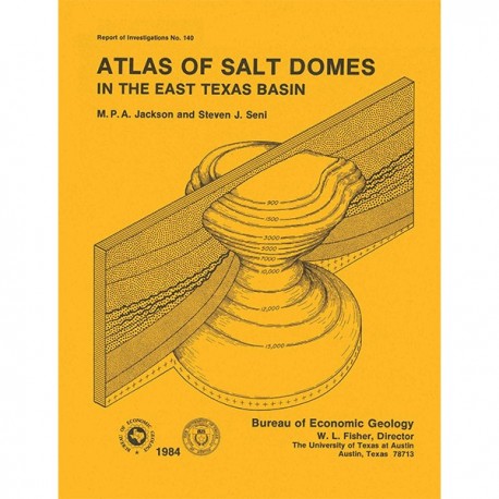
Atlas of Salt Domes in the East Texas Basin
RI0140
Atlas of Salt Domes in the East Texas Basin, by M. P. A. Jackson and S. J. Seni. 102 p., 79 figs., 1984. ISSN:0082335X: Print Version.
A free, digital version of this publication can be found on: Texas ScholarWorks
This product is no longer in stock
RI0140. Atlas of Salt Domes in the East Texas Basin, by M. P. A. Jackson and S. J. Seni. 102 p., 79 figs., 1984. ISSN:0082335X: Print.
To purchase this publication as a downloadable PDF, please order RI0140D.
ABSTRACT
Data collected during the last 5 years on the 15 shallow salt diapirs that extend upward to shallow depths (<4,000 ft, 1,220 m) in the East Texas Basin are presented here in graphical and tabular form. East Texas Basin salt diapirs penetrate and have controlled the deformation of Jurassic and younger units in the central part of the basin. The regional geologic setting of the salt diapirs is summarized, and the meaning and significance of descriptive terms are discussed. This compendium contains both primary and secondary data. Primary data are observations of dome shape, depth, structure, and resources. Examples of primary data are depths to cap rock and salt, cross-sectional area and axial ratio, crestal area and percentage planar crest, axial plunge, tilt azimuth and tilt distance, structural symmetry, side convergence, overhang azimuth and overhang percentage, and a new quantitative classification of dome shape. The structural styles of strata around each dome are also described in terms of the size of the rim syncline and drag zone around the diapir, angular relations between the strata and the salt, and style of faulting. Hydrocarbon production histories, traps, and existing uses of each dome for storage or raw materials are summarized.
Secondary data include deductions and inferences based on the primary data. The growth evolution from the pillow stage, through the diapir stage, to the post-diapir stage is described, together with unconformities resulting from erosional breaching of the dome in the past. Structural stability and hydrologic integrity of each dome are assessed in terms of the age of the most recent known deformation. Geomorphic and hydrologic evidence of dome uplift, subsidence, or brine leakage is given, as is a new classification of drainage patterns above domes.
Keywords: cap rock, diapirs, East Texas Basin, halokinesis, petroleum, salt domes, salt tectonics, structural geology
CONTENTS
ABSTRACT
INTRODUCTION
REGIONAL GEOLOGY
EXPLANATION OF ATLAS TERMINOLOGY
Gravity Expression and Depth
Shape of Salt Stock
Dome Structure Adjacent to Salt Stock
Growth History
Structural and Hydrologic Stability
Resources
SIGNIFICANCE FOR EXPLORATION
ATLAS OF SALT DOMES
Bethel Dome
Boggy Creek
Brooks
Brushy Creek Dome
Bullard Dome
Butler Dome
East Tyler Dome
Grand Saline Dome
Hainesville Dome
Keechi Dome
Mount Sylvan Dome
Oakwood Dome
Palestine Dome
Steen Dome
Whitehouse Dome
ACKNOWLEDGMENTS
REFERENCES
Figures
1. Location map showing the East Texas Basin, Gulf Coast Basin, inland salt-diapir provinces, salt domes, and salt massifs
2. Generalized stratigraphic column, East Texas Basin
3. Map of structure on top of the Louann Salt or on top of the pre-Louann surface, showing the four salt provinces in the East Texas Basin
4. Isometric block diagrams of the East Texas Basin showing three-dimensional configuration of structure contours on top of the Louann Salt or on top of the pre-Louann surface where salt is thin or absent. (A) Northwest view. (B) Northeast view
5. Map showing distribution of salt diapirs, salt pillows, and turtle-structure anticlines in the East Texas Basin
6. Map showing spatial distribution of three age groups of salt diapirs and their surrounding secondary peripheral sinks in the East Texas Basin
7. Definition of diapir shape in plan view. (A) Major axis, minor axis, and major-axis azimuth. (B) Crestal area and percentage planar crest
8. Three classes of diapir shape in plan view defined by different axial ratios
9. Parameters describing inclined diapirs
10. Four classes of structural symmetry applicable to salt diapirs
11. Derivation of a shape parameter to differentiate between diapir crests with straight or slightly curved sides and crests with strongly curved sides
12. Quantitative classification of dome shape and a plot of dome shapes from the East Texas Basin
13. Classification of the slope of the sides of diapirs
14. Parameters describing diapir overhang
15. Definition of the size of a rim syncline and drag zone in cross section
16. Definition of maximum dip of strata and the dihedral angle between strata and the salt-stock flank
17. Classification of antithetic and homothetic (equivalent to synthetic) faults around salt stocks
18. Geometry and lithofacies characteristic of the three stages of salt-dome growth: pillow stage, diapir stage, and postdiapir stage
19. Qualitative classification of drainage systems above domes into four ideal types as a guide to relative movement of the land surface above
20. Map showing shape, location, topography, and drainage system of Bethel Dome
21. Isometric block diagram of Bethel salt stock
22. Orthogonal cross sections through major and minor axes of Bethel salt
23. Structural cross section through Bethel Dome
24. Map showing shape, location, topography, and drainage system of Boggy Creek Dome
25. Isometric block diagram of Boggy Creek salt stock
26. Orthogonal cross sections through major and minor axes of Boggy Creek salt stock
27. Structural cross section through Boggy Creek Dome
28. Map showing shape, location, topography, and drainage system of Brooks Dome
29. Isometric block diagram of Brooks salt stock
30. Cross section through Brooks salt stock, which is axially symmetric
31. Structural cross section through Brooks Dome
32. Map showing shape, location, topography, and drainage system of Brushy Creek Dome
33. Isometric block diagram of Brushy Creek salt stock
34. Cross section through Brushy Creek salt stock, which is axially symmetric
35. Structural cross section through Brushy Creek Dome
36. Map showing shapes, locations, topography, and drainage systems of Bullard and Whitehouse Domes
37. Isometric block diagram of Bullard salt stock
38. Orthogonal cross sections through major and minor axes of Bullard salt stock
39. Structural cross section through Bullard Dome
40. Map showing shape, location, topography, and drainage system of Butler Dome
41. Isometric block diagram of Butler salt stock
42. Orthogonal cross sections through major and minor axes of Butler salt stock
43. Structural cross section through Butler Dome
44. Map showing shape, location, topography, and drainage system of East Tyler Dome
45. Isometric block diagram of East Tyler salt stock
46. Orthogonal cross sections through major and minor axes of East Tyler salt stock
47. Structural cross section through East Tyler Dome
48. Map showing shape, location, topography, and drainage system of Grand Saline Dome
49. Isometric block diagram of Grand Saline salt stock
50. Orthogonal cross sections through major and minor axes of Grand Saline salt stock
51. Structural cross section through Grand Saline Dome
52. Map showing shape, location, topography, and drainage system of Hainesville Dome
53. Isometric block diagram of Hainesville salt stock
54. Orthogonal cross sections through major and minor axes of Hainesville salt stock
55. Structural cross section through Hainesville Dome, based on drilling data
56. Structural cross section through Hainesville Dome, based on seismic data
57. Map showing shape, location, topography, and drainage system of Keechi Dome
58. Isometric block diagram of Keechi salt stock
59. Orthogonal cross sections through major and minor axes of Keechi salt stock
60. Structural cross section through Keechi Dome and Concord Dome, a deep-diapir area
61. Map showing shape, location, topography, and drainage system of Mount Sylvan Dome
62. Isometric block diagram of Mount Sylvan salt stock
63. Orthogonal cross sections through major and minor axes of Mount Sylvan stock
64. Structural cross section through Mount Sylvan Dome
65. Map showing shape, location, topography, and drainage system of Oakwood Dome
66. Isometric block diagram of Oakwood salt stock
67. Orthogonal cross sections through major and minor axes of Oakwood salt stock
68. Structural cross section through Oakwood Dome, based on drilling and seismic data
69. Map showing shape, location, topography, and drainage system of Palestine Dome
70. Isometric block diagram of Palestine salt stock
71. Orthogonal cross sections through major and minor axes of Palestine salt stock
72. Structural cross section through Palestine Dome
73. Map showing shape, location, topography, and drainage system of Steen Dome
74. Isometric block diagram of Steen salt stock
75. Cross sections through Steen salt stock, which is axially symmetric
76. Structural cross section through Steen Dome
77. Isometric block diagram of Whitehouse salt stock
78. Orthogonal cross sections through major and minor axes of Whitehouse salt stock
79. Structural cross section through Whitehouse Dome
Citation
Jackson, M.P.A., and Seni, S. J., 1984, Atlas of Salt Domes in the East Texas Basin: The University of Texas at Austin, Bureau of Economic Geology, Report of Investigations No. 140, 102 p.


