Reports of Investigations
-
Books & Reports
- Reports of Investigations
- Guidebooks
- Udden Series
- Geological Circulars
- Down To Earth
- Atlases of Major Oil and Gas Reservoirs
- Texas Memorial Museum Publications
- Environmental Geologic Atlas of the Texas Coastal Zone
- Mineral Resource Circulars
- Other Reports
- Seminars and Workshops
- Handbooks
- Submerged Lands of Texas
- Symposia
- Annual Reports
- Open File Reports
-
Maps & Cross Sections
- Thematic Maps
- Miscellaneous Maps, Charts & Sections
- Geologic Atlas of Texas
- STATEMAP Project Maps
- Geologic Quadrangle Maps
- Cross Sections
- Highway Geology Map
- Energy and Mineral Resource Maps
- Shoreline Change and Other Posters
- Wilcox Group, East Texas, Geological / Hydrological Folios
- Bouguer Gravity Atlas of Texas
- River Basin Regional Studies
- Featured Maps
- Posters
- Teachers & the Public
-
Geological Society Publications
- Gulf Coast Association of Geological Societies
- Alabama Geological Society
- Austin Geological Society
- Corpus Christi Geological Society
- Houston Geological Society
- Lafayette Geological Society
- Mississippi Geological Society
- New Orleans Geological Society
- South Texas Geological Society
- GCS SEPM Publications
- Historic BEG & UT Series
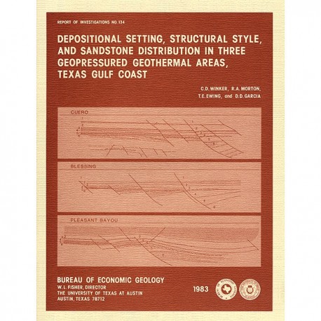
Depositional Setting, Structural Style, and Sandstone Distribution in Three Geopressured Geothermal Areas, Texas
RI0134
Depositional Setting, Structural Style, and Sandstone Distribution in Three Geopressured Geothermal Areas, Texas Gulf Coast, by C. D. Winker, R. A. Morton, T. E. Ewing, and D. D. Garcia. 60 p., 49 figs., 8 tables, 1983. ISSN: 0082335X: Print Version.
A free, digital version of this publication can be found on: Texas ScholarWorks
RI0134. Depositional Setting, Structural Style, and Sandstone Distribution in Three Geopressured Geothermal Areas, Texas Gulf Coast, by C. D. Winker, R. A. Morton, T. E. Ewing, and D. D. Garcia. 60 p., 49 figs., 8 tables, 1983. ISSN: 0082335X: Print.
To purchase this publication as a downloadable PDF, please order RI0134D.
ABSTRACT
Three areas in the Texas Gulf Coastal Plain were studied using electric logs and seismic reflection data to interpret their depositional and structural history and to compare their potential as geopressured-geothermal reservoirs. The Cuero study area, on the lower Wilcox (upper Paleocene) growth-fault trend, is characterized by closely and evenly spaced, subparallel, down-to-the-basin growth faults, relatively small expansion ratios, and minor block rotation. Distributary-channel sandstones in the geopressured lower Wilcox Group of the South Cook fault block appear to be the best geothermal aquifers in the Cuero area. The Blessing study area, on the lower Frio (Oligocene) growth-fault trend, shows wider and more variable fault spacing and much greater expansion ratios and block rotation, particularly during early Frio time. Thick geopressured sandstone aquifers are laterally more extensive in the Blessing area than in the Cuero area. The Pleasant Bayou study area, like the Blessing area, is on the Frio growth-fault trend, and its early structural development was similar; rapid movement of widely spaced faults resulted in large expansion ratios and major block rotation. However, a late-stage pattern of salt uplift and withdrawal complicated the structural style. Thick geopressured lower Frio sandstone aquifers are highly permeable and laterally extensive, as in the Blessing area.
In all three areas, geopressured aquifers were created where early, rapid movement along down-to-the-basin growth faults juxtaposed shallow-water sands against older shales, probably deposited in slope environments. Major transgressions followed the deposition of reservoir sands and probably also influenced the hydraulic isolation that allowed the buildup of abnormal pressures. Of the three areas, the Pleasant Bayou area has the best potential for geothermal energy production because of larger fault block area, greater thickness and lateral continuity of individual sandstones, and higher formation temperatures and pressures.
Keywords: geopressure, geothermal energy, Gulf Coastal Plain, Texas, seismic surveys, structural geology, Tertiary, clastic sediments
CONTENTS
ABSTRACT
INTRODUCTION
REGIONAL SETTING
METHODS OF INVESTIGATION
Stratigraphic correlation
Sandstone facies and continuity
Intervalvelocities and seismic interpretation
Structural interpretation
CUERO AREA
Stratigraphy
Interval velocities
Lower Wilcox sandstone facies
Structure
BLESSING AREA
Stratigraphy
Interval velocities
Lower Frio sandstone facies
Structure
PLEASANT BAYOU AREA
Stratigraphy
Interval velocities
Lower Frio sandstone facies
Structure
COMPARISON OF THE GEOTHERMAL ENERGY POTENTIAL OF THE THREE AREAS
ACKNOWLEDGMENTS
REFERENCES
Figures
1. Location of areas studied for this report in relation to geothermal exploration trends, Texas Gulf Coast
2. Location of Cuero study area in relation to regional facies, net-sandstone distribution, and geopressure in the lower Wilcox Group in Texas
3. Location of Blessing and Pleasant Bayou study areas in relation to regional depositional systems of the Oligocene Frio Formation in Texas
4. Location of the three study areas in relation to regional post-Edwards shelf-margin trends and shelf-margin delta complexes in the northwestern Gulf of Mexico Basin
5. Schematic cross section, central Texas Gulf Coast, showing relationship among major growth faults, expansion of section, sand depocenters, and top of geopressure
6. Time-depth curves for wells in the Cuero study area, comparing results from velocity surveys with velocity analyses and acoustic logs
7. Data base map, Cuero study area
8. Structural dip sections of the Cuero study area
9. Stratigraphic dip section (B-B') and strike section (C-C') of the lower Wilcox Group illustrating typical log facies in the Cuero area
10. Interval velocities based on velocity surveys from five wells
11. Seismic section (migrated) illustrating overall structural style of the study area
12. Seismic section (migrated) with orientation nearer to true structural dip than in figure 11
13. Lower Wilcox section in the type well, with supplementary data
14. Lower Wilcox paleogeography of the Cuero study area derived from electric-log analysis of facies
15. Geographic distribution of log patterns of three geopressured lower Wilcox sandstone aquifers in the South Cook fault block
16. Structure map of top of Wilcox Group (TW marker)
17. Structure map of top of lower Wilcox Group (D4' marker)
18. Seismic section UT-2 (migrated) crossing the South Cook fault block
19. Seismic section UT-3 (migrated)
20. Seismic section UT-4 (migrated)
21. Sequential isopach maps illustrating post-D4' structural evolution of the Cuero study area
22. Data base map, Blessing study area
23. Structural dip section. Blessing area
24. Stratigraphic sections of the lower Frio Anomalina bilateralis zone in the Blessing area
25. Interval velocities based on velocity surveys of six wells in the Blessing area
26. Geographic distribution of electric-log patterns in two lower Frio geopressured sandstone aquifers in the western part of the Blessing fault block
27. Single-fold seismic section illustrating typical structural style of the Blessing area
28. Twelve-fold seismic section (unmigrated) illustrating structural style
29. Structure map on B3 marker (upper Frio Formation), Blessing area
30. Structure map on B5 marker (lower Frio Formation), Blessing area
31. Sequential isopach maps of the Blessing area illustrating structural evolution
32. Data base map, Pleasant Bayou study area
33. Structural dip section across Chocolate Bayou field illustrating electric-log character of the correlation marker and informal stratigraphic units in the Pleasant Bayou study area
34. Stratigraphic dip section of the lower Frio Anomalina bilateralis zone across Chocolate Bayou field
35. Stratigraphic strike section of the lower Frio Anomalina bilateralis zone in the East Chocolate Bayou fault block, including the Pleasant Bayou No. 2 geothermal well
36. Interval velocities based on velocity surveys of five wells in the Pleasant Bayou study area
37. Geographic distribution of electric-log patterns of the geopressured 'A' sand, lower Frio Formation, East and South Chocolate Bayou fault blocks
38. Geographic distribution of electric-log patterns of the geopressured 'C' sand, lower Frio Formation, East and South Chocolate Bayou fault blocks
39. Geographic distribution of electric-log patterns of the geopressured 'D' sand, lower Frio Formation, East and South Chocolate Bayou fault blocks
40. Six-fold seismic strike section (unmigrated}, East Chocolate Bayou fault block
41. Twelve-fold seismic dip section (migrated) crossing East and South Chocolate Bayou fields
42. Structure on T2 horizon (top of Cibicides hazzardi zone), upper Frio Formation, Pleasant Bayou area
43. Structure on T5 horizon (top of Anomalina bilateralis zone}, lower Frio Formation
44. Twelve-fold seismic section (unmigrated} south of Danbury Dome
45. Twelve-fold seismic section (unmigrated) east of Danbury Dome
46. Twelve-fold seismic section (migrated) east of Danbury Dome
47. Sequential isopach maps of the Pleasant Bayou area illustrating structural evolution during Frio and post-Frio time
48. Dip sections of the three study areas illustrating contrast of structural styles
49. Distribution of optimum geopressured sandstone facies in the three study areas
Tables
1. Approximate stratigraphic correlation of electric-log and seismic correlation markers and informal stratigraphic units in four geothermal study areas
2. Characteristics of informal stratigraphic units in the Cuero area
3. Electric-log analysis of facies in the lower Wilcox (unit 6), used for paleogeographic mapping in the Cuero area
4. Characteristics of informal stratigraphic units in the Blessing area
5. Electric-log analysis of facies in the Anomalina bilateralis zone (unit 6), lower Frio Formation, Blessing area
6. Characteristics of informal stratigraphic units in the Pleasant Bayou area
7. Electric-log analysis of facies in the Anomalina bilateralis zone, lower Frio Formation, Pleasant Bayou area
8. Reservoir parameters for three geothermal areas in the Texas Gulf Coast
Citation
Winker, C. D., Morton, R. A., Ewing, T. E., and Garcia, D. D., 1983, Depositional Setting, Structural Style, and Sandstone Distribution in Three Geopressured Geothermal Areas, Texas Gulf Coast: The University of Texas at Austin, Bureau of Economic Geology, Report of Investigations No. 134, 60 p.
