Reports of Investigations
-
Books & Reports
- Reports of Investigations
- Guidebooks
- Udden Series
- Geological Circulars
- Down To Earth
- Atlases of Major Oil and Gas Reservoirs
- Texas Memorial Museum Publications
- Environmental Geologic Atlas of the Texas Coastal Zone
- Mineral Resource Circulars
- Other Reports
- Seminars and Workshops
- Handbooks
- Submerged Lands of Texas
- Symposia
- Annual Reports
- Open File Reports
-
Maps & Cross Sections
- Thematic Maps
- Miscellaneous Maps, Charts & Sections
- Geologic Atlas of Texas
- STATEMAP Project Maps
- Geologic Quadrangle Maps
- Cross Sections
- Highway Geology Map
- Energy and Mineral Resource Maps
- Shoreline Change and Other Posters
- Wilcox Group, East Texas, Geological / Hydrological Folios
- Bouguer Gravity Atlas of Texas
- River Basin Regional Studies
- Featured Maps
- Posters
- Teachers & the Public
-
Geological Society Publications
- Gulf Coast Association of Geological Societies
- Alabama Geological Society
- Austin Geological Society
- Corpus Christi Geological Society
- Houston Geological Society
- Lafayette Geological Society
- Mississippi Geological Society
- New Orleans Geological Society
- South Texas Geological Society
- GCS SEPM Publications
- Historic BEG & UT Series
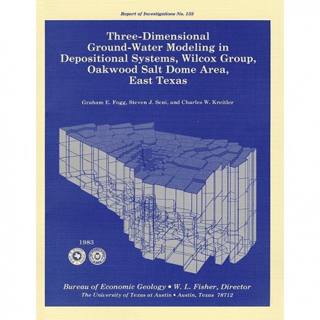
Three-Dimensional Ground-Water Modeling in Depositional Systems, Wilcox Group, Oakwood Salt Dome Area, East Texas
RI0133
Three-Dimensional Ground-Water Modeling in Depositional Systems, Wilcox Group, Oakwood Salt Dome Area, East Texas, by G. E. Fogg, S. J. Seni, and C. W. Kreitler. 55 p., 43 figs., 4 tables, 1983. ISSN: 0082335X: Print Version.
A free, digital version of this publication can be found on: Texas ScholarWorks
RI0133. Three-Dimensional Ground-Water Modeling in Depositional Systems, Wilcox Group, Oakwood Salt Dome Area, East Texas, by G. E. Fogg, S. J. Seni, and C. W. Kreitler. 55 p., 43 figs., 4 tables, 1983. ISSN: 0082335X: Print.
To purchase this publication as a downloadable PDF, please order RI0133D.
ABSTRACT
A three-dimensional model was constructed of ground-water flow in the Wilcox-Carrizo aquifer system near Oakwood salt dome to facilitate understanding the hydrogeology around salt domes of the Gulf interior region and ultimately to evaluate the hydrologic suitability of Oakwood Dome for storage of high-level nuclear waste. The data base includes not only measurements of hydraulic head and hydraulic conductivity but also lithofacies maps constructed in a previous study of Wilcox depositional systems.
The Carrizo aquifer is a fairly homogeneous sand sheet overlying the much thicker Wilcox Group, a multiple-aquifer system composed primarily of fluvial channel-fill sand bodies distributed among lower permeability interchannel sands and muds. The interconnectedness of the channel-fill sands, which have predictable values of hydraulic conductivity, strongly influences the rate and direction of ground-water flow. Lateral interconnectedness may depend largely on frequency distributions of channel-fill sands (that is, sand percent). Vertical interconnectedness is apparently poor owing to the horizontal stratification of sand and mud. Simulating observed pressure-depth trends by manipulating values of equivalent vertical hydraulic conductivity (K,') demonstrates that the ratio of vertical to horizontal conductivity (K,'/Khr) is very low (approximately 10 -3 to 10-4). Locally high values of K,' could result in locally rapid vertical flow, which could in turn be detected using pressure-depth data. Ground-water velocities and travel times computed by the model indicate ground-water residence times of 103 to 104 years in channel-fill facies and 105 to 106 years in interchannel facies. Because Oakwood Dome is apparently surrounded by interchannel facies as a result of syndepositional dome growth, the dome may be essentially isolated from circulating Wilcox ground water. A possible exception is where channel-fill facies appear to touch or come close to the northeast flank, coinciding with a brackish-water plume that apparently results from dissolution of salt or cap rock. The northeast orientation of the plume appears to be caused by sand-body distribution and interconnection.
Keywords: ground-water modeling, hydrogeology, Oakwood Dome, Wilcox Group, Carrizo Sand, salt domes, waste disposal, depositional systems, Texas
CONTENTS
ABSTRACT
INTRODUCTION
HYDROGEOLOGY
Regional setting
Oakwood Dome vicinity
Hydraulic head.
Pressure versus depth
Total dissolved solids
Ground·water chemistry
Hydraulic conductivity
Field pumping tests
Laboratory permeameter tests
Comparison of field and laboratory tests.
Aquifer mapping
Sand-body interconnectedness
COMPUTER PROGRAMS
MODELING PROCEDURE
Lateral boundaries
Integrated finite difference mesh construction
Boundary conditions
Lateral boundary conditions
Vertical·leakage boundary condition
Equivalent hydraulic conductivity
Simulations
RESULTS AND DISCUSSION
Vertical interconnection of sand bodies
Lateral interconnection of sand bodies
Topographic effects and updip flow directions
Hydraulic conductivity of the Reklaw aquitard
Effects of inserting locally high vertical conductivity values at the Trinity River boundary
Comparison of measured and computed heads
Areas of maximum potential for discharge
Ground-water budgets computed by the model
Ground·water travel times
SUMMARY AND CONCLUSIONS
Applicability to salt dome studies in Louisiana and Mississippi
ACKNOWLEDGMENTS
REFERENCES
Figures
1. Location of model area
2. Hydrostratigraphic column showing Tertiary Wilcox and Claiborne Groups and underlying Cretaceous formations (Midway and Navarro Groups)
3. Regional structural cross section through the study area
4. Potentiometric surface map for the Carrizo aquifer over Oakwood salt dome
5. Potentiometric surface map for the Wilcox aquifer in the Oakwood Dome vicinity
6. Potentiometric surface map for the Carrizo aquifer in the Oakwood Dome vicinity
7. Relationship between elevation of the water table and land surface in the Queen City aquifer, Leon and Freestone Counties
8. Pressure-versus-depth relationship for data within 2 mi (3.22 km) of the Carrizo-Reklaw surface contact
9. Pressure-versus-depth relationship based on water level and pressure measurements made at drill site TOH-2, 2,000 ft (610 m) southeast of Oakwood salt dome
10. Electrical-resistivity-log estimates of total dissolved solids (TDS; mg/ L) in Wilcox-Carrizo sands around Oakwood Dome.
11. Histograms showing hydraulic conductivity (K) distributions from pumping tests and laboratory permeameter tests
12. Results of laboratory permeameter tests conducted on Wilcox core and of pumping tests conducted in adjacent water wells
13. Comparison of arithmetic-normal and log-normal frequency distributions
14. Sample calculations of equivalent horizontal hydraulic conductivity (Kh') of a section of the Wilcox aquifer
15. Sand-percent map of channel-fill sands (R., > 20 ohm-m) for upper layer of the model
16. Sand-percent map of channel-fill sands (R., > 20 ohm-m) for middle layer of the model
17. Sand-percent map of channel-fill sands (R., > 20 ohm-m) for lower layer of the model
18. Example of how the integrated finite difference (IFD) mesh is generated with program OGRE
19. Plan view of the IFD mesh and surface geology from Barnes (1967 and 1970)
20. Structure-contour map on top of Wilcox Group (base of Carrizo Sand)
21. Structure-contour map on base of Wilcox Group
22. Three-dimensional perspective from the southwest of the outer surface of the IFD mesh generated from the structure-contour maps using program OGRE
23. Three-dimensional perspective from the southeast of the upper surface of the IFD mesh
24. Map of IFD mesh, values of hydraulic head prescribed on lateral boundaries, and nodal areas where the Reklaw aquitard is absent in the model
25. Schematic cross section showing values of horizontal head differential (Llh) that would occur if pressure-versus-depth (P-D) slopes· (m) were assumed to be uniformly equal to 0.95 and 1.05 at updip and downdip boundaries, respectively
26. Schematic cross section depicting how vertical-leakage boundary condition was prescribed
27. Map of Queen City water table calculated from the observed water-table/ topography relationship shown in figure 7
28. Values of equivalent horizontal hydraulic conductivity (K1,') calculated for each layer of the model
29. Contour maps of vertical hydraulic gradient (ah/oz) computed between upper and middle and middle and lower layers in simulations (a) Bl, (b) A, and (c) B2
30. Contour maps of hydraulic head computed in simulation A
31. Contour maps of hydraulic head computed in simulation C2
32. Maps showing ground-water velocity vectors (specific discharge) computed in simulation A
33. Maps of ground-water velocity vectors (specific discharge) computed in simulation C2
34. Contour maps of hydraulic head computed in simulation D showing effects of reducing hydraulic conductivity of the Reklaw aquitard
35. Contour maps of hydraulic head computed in simulation E showing effects of increasing the value of Kv' at a node location near the Trinity River boundary
36. Maps of velocity vectors computed in simulation E showing effects of increasing the value of Kv' at a node location near the Trinity River boundary
37. Contour maps of vertical hydraulic gradients (Clh/Clz) computed in simulation E depicting effects of increasing the value of Kv' at a node location near the Trinity River boundary
38. Comparisons of measurement-based and model-generated (simulation E) potentiometric surfaces for (a) upper layer and Wilcox and (b) upper layer and Carrizo
39. Comparisons of measurement-based and model-generated (simulation E) potentiometric surfaces for (a) middle layer and Wilcox and (b) middle layer and Carrizo
40. Maps depicting areas of maximum potential for discharge based on simulations A and E
41. Map showing directions of leakage across the Reklaw aquitard based on simulation D
42. Maps showing ground-water travel times for the middle and lower layers based on simulation A
43. Maps showing ground-water travel times for the middle and lower layers based on simulation E
Tables
1. Pressure-versus-depth (P-D) relationships
2. Field pumping test results from the model area and vicinity
3. Summary of conditions imposed during each simulation
4. Ground-water budgets computed by the model
Citation
Fogg, G. E., Seni, S. J., and Kreitler, C. W., 1983, Three-Dimensional Ground-Water Modeling in Depositional Systems, Wilcox Group, Oakwood Salt Dome Area, East Texas: The University of Texas at Austin, Bureau of Economic Geology, Report of Investigations No. 133, 55 p.


