Reports of Investigations
-
Books & Reports
- Reports of Investigations
- Guidebooks
- Udden Series
- Geological Circulars
- Down To Earth
- Atlases of Major Oil and Gas Reservoirs
- Texas Memorial Museum Publications
- Environmental Geologic Atlas of the Texas Coastal Zone
- Mineral Resource Circulars
- Other Reports
- Seminars and Workshops
- Handbooks
- Submerged Lands of Texas
- Symposia
- Annual Reports
- Open File Reports
-
Maps & Cross Sections
- Thematic Maps
- Miscellaneous Maps, Charts & Sections
- Geologic Atlas of Texas
- STATEMAP Project Maps
- Geologic Quadrangle Maps
- Cross Sections
- Highway Geology Map
- Energy and Mineral Resource Maps
- Shoreline Change and Other Posters
- Wilcox Group, East Texas, Geological / Hydrological Folios
- Bouguer Gravity Atlas of Texas
- River Basin Regional Studies
- Featured Maps
- Posters
- Teachers & the Public
-
Geological Society Publications
- Gulf Coast Association of Geological Societies
- Alabama Geological Society
- Austin Geological Society
- Corpus Christi Geological Society
- Houston Geological Society
- Lafayette Geological Society
- Mississippi Geological Society
- New Orleans Geological Society
- South Texas Geological Society
- GCS SEPM Publications
- Historic BEG & UT Series


Facies and Stratigraphy of the San Andres Formation, Northern and Northwestern Shelves of the Midland Basin, Texas
RI0128
Facies and Stratigraphy of the San Andres Formation, Northern and Northwestern Shelves of the Midland Basin, Texas and New Mexico, by P. J. Ramondetta. 56 p., 41 figs., 3 tables, 1982. Print Version.
A free, digital version of this publication can be found on: Texas ScholarWorks
RI0128. Facies and Stratigraphy of the San Andres Formation, Northern and Northwestern Shelves of the Midland Basin, Texas and New Mexico, by P. J. Ramondetta. 56 p., 41 figs., 3 tables, 1982.
To purchase this publication as a downloadable PDF, please order RI0128D.
ABSTRACT
The San Andres Formation on the Northern and Northwestern Shelves of the Midland Basin is a progradational stratigraphic unit consisting predominantly of carbonate facies. Lithofacies include dolomite, laminated anhydrite and dolomite, massive bedded anhydrite, limestone, salt, and red beds. These lithofacies represent depositional environments that include deep-water outer shelf, shallow-water inner shelf, shallow-water to emergent shoals, and a sabkha complex that comprises intertidal to supratidal algal mud flats, hypersaline lagoons or brine pans, and terrigenous mud flats.
Deposition was cyclic; a cycle began with a transgression followed by a gradual shoaling-upward sequence. Cycles commonly terminated with subaerial exposure before renewed transgression initiated a new cycle. Much of the dolomitization probably occurred during periods of subaerial exposure in schizohaline environments. Likewise, porosity was probably also developed during subaerial exposure. Surface topography probably exerted considerable control on dolomitization and porosity development. Additional diagenetic alteration of carbonates may have occurred as a result of an influx of hypersaline brine.
San Andres reservoirs of the Northern and Northwestern Shelves yielded 12.7 percent of the total oil production for the State of Texas in 1980. Trapping mechanisms for the oil are both structural and stratigraphic. Maps and cross sections in this report document the nature of these mechanisms. Large volumes of oil are trapped in a discontinuous, structurally high, and stratigraphically thin belt that rims the deep northern Midland Basin and that overlies older shelf margins. Porosity zones thin updip from this belt; source rocks are subjacent to this belt of porosity. Additional oil is trapped in a series of steplike, updip porosity pinch-outs exhibiting little or nonstructural control. Regional porosity pinch-outs control the northern limits of oil production in the Northern and Northwestern Shelves of Texas and eastern New Mexico.
Keywords: lithofacies, Midland Basin, New Mexico, Northern Shelf, Northwestern Shelf, oil and gas, San Andres, San Andres Formation, Texas
CONTENTS
ABSTRACT
INTRODUCTION
METHODS
STRATIGRAPHY
LITHOFACIES
DOLOMITE
LIMESTONE
ANHYDRITE
RED BEDS
SALT
DEPOSITIONAL ENVIRONMENTS
CYCLICITY OF DEPOSITIONAL ENVIRONMENTS
ADDITIONAL EVIDENCE FOR SUBAERIAL EXPOSURE
POROSITY CONTROLS
OIL AND GAS PRODUCTION
PRODUCTION DATA
STRUCTURAL CONTROL
STRATIGRAPHIC CONTROL
CONCLUSIONS
ACKNOWLEDGMENTS
REFERENCES
FIGURES
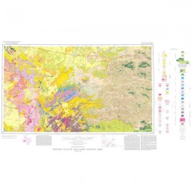
1. Map of the Northern and Northwestern Shelves showing oil fields and percent total accumulative San Andres oil production within each region
2. Map of study area in Texas showing San Andres oil production, shelf margins, and surface lineaments
3. Map of the Northern and Northwestern Shelves showing well control and lines of cross section
4. Schematic block diagram of depositional environments during a regressive depositional phase in early San Andres time
5. North-south cross section of San Andres Formation across the Northern Shelf
6. Distribution of lithofacies during much of early San Andres time
7. Gamma-ray, neutron log, and lithic interpretation of San Andres strata, Lamb County, Texas
8. Dolomitized mudstone and intraclasts, Yoakum County, Texas
9. Photomicrograph (SEM) of dolomite rhombs from a San Andres oil -producing zone
10. Wispy-laminated crinoidal packstone, Lamb County, Texas
11. Fossiliferous dolomite, Swisher County, Texas
12. (a) Laminated, nonporous anhydrite and dolomite, lower San Andres Formation, (b) laminated anhydrite and dolomite, (c) laminated anhydrite and dolomite with enterolithic folding, (d) massive gypsum in outcrop
13. Concentrated organic matter adjacent to displacive nodules of anhydrite
14. Replacement of skeletal debris and voids by secondary anhydrite
15. Erosional upper contact of San Andres cycle 4
16. Banded salt
17. Histogram of impurities in San Andres cycle 4 salt
18. Chaotic mud salt
19. North-south cross section of San Andres Formation across the Anton Irish field, Texas
20. Structure map, base of San Andres Formation
21. Structure map of -rr marker
22. Structure map, top of San Andres Formation
23. lsopach map, lower San Andres Formation
24. lsopach map, upper San Andres Formation
25. lsopach map, San Andres Formation
26. lsopach map, upper San Andres Formation, Yoakum and Terry Counties, Texas
27. Plot of porosity versus permeability and resistivity log from the Yellowhouse dolomite
28. Gamma-ray, neutron log, and lithic interpretation, San Andres strata, Pan American Fitzgerald No. 1, Yoakum County, Texas
29. Gamma-ray, sonic log, and lithic interpretation, San Andres strata, Tenneco O'Dowd No. 5, Yoakum County, Texas
30. lsopach map of cycle 4 salt, San Andres Formation, Palo Duro Basin, Texas and New Mexico
31. Cross section of cycle 4 salt, San Andres Formation, across an area of salt thinning
32. Structure map, basal mudstone of cycle 4, San Andres Formation, Palo Duro Basin, Texas and New Mexico
33. Structure map, top of Yellowhouse dolomite, San Andres Formation, northern Hockley and southern Lamb Counties, Texas
34. Map of the Northern and Northwestern Shelves showing San Andres petroleum productivity in each region
35. Distribution of source-rock facies
36. North-south cross section of San Andres Formation across Levelland and Slaughter fields, Texas
37. lsopach map of interval between the top of the Yellowhouse dolomite and the rr marker, San Andres Formation
38. lsopach map of interval between the total depth of producing oil wells (with o pen-hole completions) and the -rr marker, San Andres Formation
39. North-south cross section of San Andres Formation across the Northwestern Shelf, New Mexico
40. Gamma-ray, density log, and lithic interpretation of lower San Andres Formation, Roosevelt County, New Mexico
41. Structure map, -rr marker, Twin Lakes oil field, Chaves County, New Mexico
TABLES
1. Stratigraphic chart, northern Midland Basin
2. Production data for San Andres oil fields, Northern Shelf, Texas
3. Production data for San Andres oil fields, Northwestern Shelf, New Mexico
Citation
Ramondettta, P. J., 1982, Facies and Stratigraphy of the San Andres Formation, Northern and Northwestern Shelves of the Midland Basin, Texas and New Mexico: The University of Texas at Austin, Bureau of Economic Geology, Report of Investigations No. 128, 56 p.