Bureau of Economic Geology Publications
| Title | Publication Year Sort ascending | Abstract | Author | Publisher | |
|---|---|---|---|---|---|
|
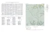
Geology of Hood Spring quadrangle, Brewster County, Texas | 1954 | The Hood Spring quadrangle, in the central part of Brewster County, Texas, contains a segment of the southeast rim of the Marathon basin. |
Graves, R.W. | Bureau of Economic Geology |
|
Handbook of Cretaceous Foraminifera of Texas | 1954 | Preparation of a desk-side reference manual of Cretaceous foraminifera was undertaken as a project of the Bureau of Economic Geology, where I was a staff member during the summers of 1945 to 1947 and during July of 1951. |
Frizzell, D.L. | Bureau of Economic Geology |
|
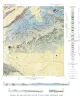
Geologic Map and Structure Sections of Hood Spring Quadrangle, Texas | 1954 | Graves, R.W. | Bureau of Economic Geology | |
|
Phosphorite in eastern Llano uplift of central Texas | 1954 | A deposit of phosphorite, estimated to be 11 feet thick, was found March 26, 1952, while the writer was mapping ancient sink fillings and collapse structures within the outcrop area of the Honeycut formation south of Marble Falls, Texas. |
Barnes, V.E. | Bureau of Economic Geology |
|
The faunas of the Riley Formation in central Texas | 1954 | Sixty-eight species of trilobites, 10 species of inarticulate brachiopods, two species of articulate brachiopods, one ostracode and fragments of sponges, pelmatozoan echinoderms and unidentifiable organisms constitute the faunas of the Riley formation. |
Palmer, A.R. | Bureau of Economic Geology |
|
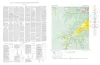
Geologic map of the Wendel Quadrangle, Kimble, Kerr, and Gillespie Counties, Texas | 1954 | Wendel quadrangle is entirely within the Edwards Plateau province and is situated southwest of the Llano region. |
Barnes, V.E. | Bureau of Economic Geology |
|
Geologic map of the Harper quadrangle, Gillespie County, Texas | 1954 | Harper quadrangle is in the Edwards Plateau province south of the Llano region. The plateau surface within the quadrangle is dissected by the Pedernales River and its tributaries in the southern part, and by Threadgill and Edwards Creeks in the northern part. |
Barnes, V.E. | Bureau of Economic Geology |
|
Geologic map of the Dry Branch quadrangle, Gillespie and Kerr Counties, Texas | 1954 | Dry Branch quadrangle is in the Edwards Plateau province southwest of the Llano region. |
Barnes, V.E. | Bureau of Economic Geology |
|
Geologic map of the Klein Branch quadrangle, Gillespie and Kerr Counties, Texas | 1954 | Barnes, V.E. | Bureau of Economic Geology | |
|
Geologic map of the Threadgill Creek quadrangle, Gillespie and Kerr Counties, Texas | 1954 | Barnes, V.E. | Bureau of Economic Geology |