|
New Early Miocene Formation and Vertebrate Local Fauna, Big Bend National Park, Brewster County, Texas |
|
1969 |
Texas Memorial Museum |
|
Edwards Formation (Lower Cretaceous), Texas: dolomitization in a carbonate platform system |
Fisher, W.L., Rodda, P.U. |
1969 |
Geological Circular |
|
New Fossil Rodents...Rancho Gaitan Local Fauna, Early Chadronian, Northeastern Chihuahua, Mexico |
|
1969 |
Texas Memorial Museum |
|
Sulfur in West Texas: its geology and economics |
Zimmerman, J.B., Thomas, Eugene |
1969 |
Geological Circular |
|
Virgil and lower Wolfcamp repetitive environments and the depositional model, north-central Texas |
Brown, L.F., Jr. |
1969 |
Geological Circular |
|
Geometry and distribution of fluvial and deltaic sandstones (Pennsylvanian and Permian), north-central Texas |
Brown, L.F., Jr. |
1969 |
Geological Circular |
|
The Mineral Industry of Texas in 1968 |
Netzeband, F.F., Girard, R.M. |
1969 |
Mineral Resource Circular |
|
Delta Systems in the Exploration for Oil and Gas |
Fisher, W.L., Brown, L.F., Jr., Scott, A.J., McGowen, J.H. |
1969 |
Educational Material |
|
Palynology of the Eddleman Coal (Pennsylvanian) of north-central Texas |
Stone, J.F. |
1969 |
Report of Investigations |
|
GCAGS Transactions Volume 19 (1969) Miami |
|
1969 |
Gulf Coast Association of Geological Societies |
|
Annual Report of the Bureau of Economic Geology 1969 |
University of Texas at Austin, Bureau of Economic Geology |
1969 |
Annual Reports |
|
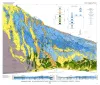
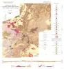
Geology of Apache Mountains, Trans-Pecos Texas |
Wood, J.W. |
1968 |
Geologic Quadrangle Map |
|
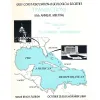
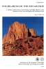
The Big Bend of the Rio Grande -- a guide to the rocks, landscape, geologic history, and settlers of the area of Big Bend National Park |
Maxwell, R.A. |
1968 |
Guidebook |
|
Igneous Geology of the Central Davis Mountains, Jeff Davis County, Texas |
Anderson, J.E. |
1968 |
Geologic Quadrangle Map |

|
New Brazilian Forms of Hyla |
|
1968 |
Texas Memorial Museum |
|
Taxonomy of the Neotropical Hylidae |
|
1968 |
Texas Memorial Museum |
|
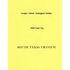
South Texas Uranium |
|
1968 |
Corpus Christi Geological Society |

|
Geographic Variation in Brazilian Species of Hyla |
|
1968 |
Texas Memorial Museum |
|
Bonfire Shelter: A Stratified Bison Kill Site, Val Verde County, Texas |
|
1968 |
Texas Memorial Museum |

|
Remarks on the Geographical Distribution and Phyletic Trends of South American Toads |
|
1968 |
Texas Memorial Museum |