|
Sand resources of Texas gulf coast |
Garner, L.E. |
1967 |
Report of Investigations |
|
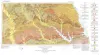
Geologic Atlas of Texas, Palestine sheet (revised 1993) |
Barnes, V.E., Humble Oil and Refining Co., Shell Oil Co., Pan American Petroleum Corp., Mobil Oil Co., Wright, A.C., McCallum, H.D., Wendlandt, E.A., Burford, S.O., Shelby, T.H., Gibson, D.T., Eaton, R.W., Shelby, C.A., Pieper, M.K. |
1967 |
Geologic Atlas of Texas |

|
A Population of Woodrats (Neotoma micropus) in Southern Texas |
|
1966 |
Texas Memorial Museum |

|
The Osteology and Relationships of the Pliocene Ground Squirrel...from the Ogallala Formation |
|
1966 |
Texas Memorial Museum |
|
The Status of Bootherium brazosis |
|
1966 |
Texas Memorial Museum |
|
The Onion Creek Mosasaur |
|
1966 |
Texas Memorial Museum |
|
Annual Report of the Bureau of Economic Geology 1966 |
University of Texas at Austin, Bureau of Economic Geology |
1966 |
Annual Reports |
|
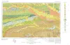
Geologic Atlas of Texas, Texarkana sheet (reprinted 1979 with base revised) |
Barnes, V.E., Humble Oil and Refining Co., Shell Oil Co., Pan American Petroleum Corp., Arkansas Geological and Conservation Commission, Oklahoma Geological Survey, McCallum, H.D., Wendlandt, E.A., Burford, S.O., Gibson, D.T., Eaton, R.W. |
1966 |
Geologic Atlas of Texas |
|
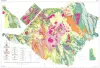
Geologic map of the Big Bend National Park, Brewster County, Texas |
Maxwell, R.A. |
1966 |
Miscellaneous Map |

|
Deltas in Their Geologic Framework |
|
1966 |
Houston Geological Society |
|
Limestone and dolomite resources, Lower Cretaceous rocks, Texas |
Rodda, P.U., Fisher, W.L., Payne, W.R., Schofield, D.A. |
1966 |
Report of Investigations |
|
Sedimentary petrology and history of the Haymond Formation (Pennsylvanian), Marathon Basin, Texas |
McBride, E.F. |
1966 |
Report of Investigations |
|
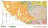
Geology of Presidio Area, Presidio County, Texas |
Dietrich, J.W. |
1966 |
Geologic Quadrangle Map |
|
Nomenclature revision of basal Cretaceous rocks between the Colorado and Red Rivers, Texas |
Fisher, W.L., Rodda, P.U. |
1966 |
Report of Investigations |
|
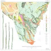
Geology of Black Gap Area, Brewster County, Texas |
St. John, D.E. |
1966 |
Geologic Quadrangle Map |
|
GCAGS Transactions Volume 16 (1966) Lafayette |
|
1966 |
Gulf Coast Association of Geological Societies |
|
Blancan Mammalian Fauna and Pleistocene Formations, Hudspeth County, Texas |
|
1966 |
Texas Memorial Museum |
|
Bloating characteristics of East Texas clays |
Fisher, W.L., Garner, L.E. |
1965 |
Geological Circular |
|
Texas Mineral Resources: Problems and Predictions |
Flawn, P.T. |
1965 |
Geological Circular |
|
A revision of Taylor nomenclature, Upper Cretaceous, central Texas |
Young, Keith |
1965 |
Geological Circular |