|
Oil and gas in fractured crystalline igneous and metamorphic rocks: global overview and examples from Texas |
Shuster, M.W., Zahm, C.K., Hennings, P.H. |
2021 |
Report of Investigations |
|
Annual Report of the Bureau of Economic Geology 2021 |
University of Texas at Austin, Bureau of Economic Geology |
2021 |
Annual Reports |
|
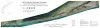
Gulf of Mexico Shoreline Change, Southern Padre Island and Brazos Island, Texas: Rio Grande (U.S./Mexico Border) to Port Mansfield Channel |
Caudle, T.L., Paine, J.G., Andrews, J.R., Suarez, J.R. |
2021 |
Posters |
|
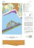
Geologic map of the Frozen Point and Caplen quadrangles, Texas Gulf of Mexico coast |
Caudle, T.L., Paine, J.G. |
2021 |
Open-File Map |
|
Texas mineral resources within or affected by Proterozoic basement architecture |
Kyle, J.R., Elliott, Brent A. |
2021 |
Report of Investigations |
|
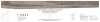
Gulf of Mexico Shoreline Change, Eastern Matagorda Peninsula, Texas: Colorado River to Brazos River |
Caudle, T.L., Paine, J.G., Andrews, J.R., Suarez, J.R. |
2021 |
Posters |
|
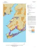
Geologic map of the Palacios and part of the Palacios Point quadrangles, Texas Gulf of Mexico coast |
Paine, J.G., Costard, L. |
2021 |
Open-File Map |
|
Hydrogeology of the Texas basement |
Nicot, J.P. |
2021 |
Report of Investigations |
|
The Wichita Paleoplain in the Llano Uplift, Texas |
Rose, P.R., Ewing, T.E., Woodruff, C.M., Jr. |
2021 |
Austin Geological Society |
|
Gulf of Mexico Shoreline Change, Bolivar Peninsula, Texas: Bolivar Roads to High Island |
Caudle, T.L., Paine, J.G., Andrews, J.R., Suarez, J.R. |
2021 |
Posters |
|
Geologic map of the Turtle Bay quadrangle, Texas Gulf of Mexico coast |
Paine, J.G., Costard, L. |
2021 |
Open-File Map |
|
Basement-rooted faults of the Delaware Basin and Central Basin Platform, Permian Basin, West Texas and southeastern New Mexico |
Horne, E.A., Hennings, P.H., Zahm, C.K. |
2021 |
Report of Investigations |
|
Gulf of Mexico Shoreline Change, Mustang Island and North Padre Island, Texas: Northern Padre Island to Aransas Pass |
Caudle, T.L., Paine, J.G., Andrews, J.R., Suarez, J.R. |
2021 |
Posters |
|
Geologic map of the Grit quadrangle, Mason County, Texas |
Hunt, B.B., Johnson, B., Helper, M.A. |
2021 |
Open-File Map |
|
Gulf of Mexico Shoreline Change, Galveston Island, Texas: San Luis Pass to Bolivar Roads |
Caudle, T.L., Paine, J.G., Andrews, J.R., Suarez, J.R. |
2021 |
Posters |
|
Geologic map of the Lytton Springs quadrangle, Texas |
Woodruff, C.M., Jr., Costard, L. |
2021 |
Open-File Map |
|
A systematic approach to identifying hydrocarbon sweet spots using integrated seismic multiattribute, wireline-log, and core analyses: case study from the Upper Cretaceous Taylor Serbin field, southeast Texas |
Ogiesoba, O. C., Ambrose, W.A. |
2021 |
Report of Investigations |
|
Gulf of Mexico Shoreline Change, Brazos River to San Luis Pass, Texas |
Caudle, T.L., Paine, J.G., Andrews, J.R., Suarez, J.R. |
2021 |
Posters |
|
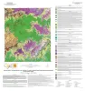
Geologic map of the Pedernales Falls, Johnson City, Howell Mountain, and Round Mountain quadrangles, Blanco County, Texas |
Hunt, B.B., Woodruff, C.M., Jr., Barnes, V.E. |
2021 |
Open-File Map |
|
Gulf of Mexico Shoreline Change, High Island to Sabine Pass, Texas |
Caudle, T.L., Paine, J.G., Andrews, J.R., Suarez, J.R. |
2021 |
Posters |