|
Spatial variability in unsaturated flow beneath playa and adjacent interplaya settings and implications for contaminant transport, southern High Plains, Texas |
Scanlon, B.R., Goldsmith, R.S., Mullican, W.F. |
1997 |
Report of Investigations |
|
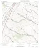
Geologic map of the Texas Mountain quadrangle, Texas |
Collins, E.W. |
1997 |
Open-File Map |
|
The Application of a Coalbed Methane Producibility Model in Defining Coalbed Methane Exploration Fairways and Sweet Spots: Examples from the San Juan, Sand Wash, and Piceance Basins |
Tyler, Roger, Scott, A.R., Kaiser, W.R., McMurry, R.G. |
1997 |
Report of Investigations |
|
Geologic map of the Timber Creek Quadrangle, Texas |
Collins, E.W. |
1997 |
Open-File Map |
|
Quaternary faults within intermontane basins of northwest Trans-Pecos Texas and Chihuahua, Mexico |
Collins, E.W., Raney, J.A. |
1997 |
Report of Investigations |
|
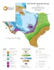
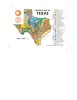
Tectonic Map of Texas |
University of Texas at Austin, Bureau of Economic Geology |
1997 |
Thematic Maps |
|
Geologic map of the Twin Hollow Quadrangle, Texas |
Collins, E.W. |
1997 |
Open-File Map |
|
Conceptual Breakthroughs in Salt Tectonics: A Historical Review, 1856-1993 |
Jackson, M.P.A. |
1997 |
Report of Investigations |
|
Down to earth at McKinney Falls State Park, Texas |
Raney, J.A. |
1997 |
Down To Earth |
|
Extent, Mass, and Duration of Hydrocarbon Plumes from Leaking Petroleum Storage Tank Sites in Texas |
Mace, R.E., Fisher, S.R., Welch, D.M., Parra, S.P. |
1997 |
Geological Circular |
|
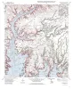
Geologic map of the Cobbs Cavern quadrangle, Texas |
Collins, E.W. |
1997 |
Open-File Map |
|
Electrical Imaging Catalog: Microresistivity Images and Core Photos from Fractured, Karsted, and Brecciated Carbonates |
Hammes, Ursula |
1997 |
Geological Circular |
|
Geologic map of the Jarrell Quadrangle, Texas |
Collins, E.W. |
1997 |
Open-File Map |
|
Geologic Map of Texas - Postcard |
University of Texas at Austin, Bureau of Economic Geology |
1997 |
Miscellaneous Map |
|
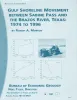
Gulf shoreline movement between Sabine Pass and the Brazos River, Texas: 1974 to 1996 |
Morton, R.A. |
1997 |
Geological Circular |
|
Geologic map of the Rough Canyon Quadrangle, Texas |
Collins, E.W. |
1997 |
Open-File Map |
|
A Practical Use of Vertical Seismic Profiles-Stratigraphic Calibration of 3-D Seismic Data - Downloadable PDF |
Hardage, B.A. |
1997 |
Geological Circular |
|
Principles of Onshore 3-D Seismic Design |
Hardage, B.A. |
1997 |
Geological Circular |
|
Geologic map of the Round Rock quadrangle, Texas |
Collins, E.W. |
1997 |
Open-File Map |
|
Basin morphological controls on submarine-fan depositional trends: Spraberry Sandstone, Permian Basin, Texas |
Tyler, Noel, Gholston, J.C., Guevara, E.H. |
1997 |
Geological Circular |