|
On Solid Ground: Memoirs of a Texas Geologist |
Barnes, V.E. |
1995 |
Selected Reports |
|
Controls on reservoir heterogeneity in Permian shallow-water-platform carbonate reservoirs, Permian Basin: implications for improved recovery |
Ruppel, S.C., Kerans, Charles, Major, R.P., Holtz, M.H. |
1995 |
Geological Circular |
|
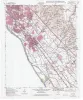
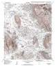
Geologic map of the Fort Bliss SE Quadrangle, Texas |
Collins, E.W. |
1995 |
Open-File Map |
|
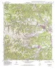
Geologic map of the Ysleta quadrangle, Texas |
Collins, E.W., Raney, J.A. |
1995 |
Open-File Map |
|
Identification and assessment of remaining oil resources in the Frio fluvial-deltaic sandstone play, south Texas |
Holtz, M.H., McRae, L.E. |
1995 |
Report of Investigations |

|
Naturally Occurring Radioactive Materials (NORM) in Produced Water and Scale from Texas Oil, Gas, and Geothermal Wells |
Fisher, R.S. |
1995 |
Geological Circular |
|
Geologic and Hydrologic Assessment of Natural Gas from Coal: Greater Green River, Piceance, Powder River, and Raton Basins, Western United States |
Tyler, Roger, Kaiser, W.R., Scott, A.R., Hamilton, D.S., Ambrose, W.A. |
1995 |
Report of Investigations |
|
Seismic analysis of the Duval County Ranch area, south Texas: assessment of exploration potential of the Wilcox, Queen City, and Jackson-Yegua plays |
Fiduk, J.C., Hamilton, D.S. |
1995 |
Geological Circular |
|
Geologic map of the Medina Lake Quadrangle, Texas |
Collins, E.W. |
1995 |
Open-File Map |
|
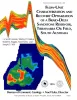
Origin and development of playa basins, sources of recharge to the Ogallala aquifer, southern High Plains, Texas and New Mexico |
Gustavson, T.C., Holliday, V.T., Hovorka, S.D. |
1995 |
Report of Investigations |
|
Geologic map of the Helms West Well Quadrangle, Texas |
Collins, E.W., Raney, J.A. |
1995 |
Open-File Map |
|
Geologic map of the Pipe Creek Quadrangle, Texas |
Collins, E.W. |
1995 |
Open-File Map |
|
Chert reservoir development in the Devonian Thirtyone Formation: Three Bar field, West Texas |
Ruppel, S.C., Hovorka, S.D. |
1995 |
Report of Investigations |
|
Geologic map of the Hueco Tanks Quadrangle, Texas |
Collins, E.W., Raney, J.A. |
1995 |
Open-File Map |
|
Flow-Unit Characterization and Recovery Optimization of a Braid-Delta Sandstone Reservoir, Tirrawarra Oil Field, South Australia |
Hamlin, H.S., Dutton, S.P., Seggie, R.J., Tyler, Noel, Yeh, J.S. |
1995 |
Report of Investigations |
|
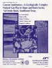
Canyon sandstones -- a geologically complex natural gas play in slope and basin facies, Val Verde basin, southwest Texas |
Hamlin, H.S., Clift, S.J., Dutton, S.P., Hentz, T.F., Laubach, S.E. |
1995 |
Report of Investigations |
|
Geologic map of the Ranger Creek Quadrangle, Texas |
Collins, E.W. |
1995 |
Open-File Map |
|
Geologic map of the Waring quadrangle, Texas |
Collins, E.W. |
1995 |
Open-File Map |
|
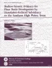
Shallow-seismic evidence for playa basin development by dissolution-induced subsidence on the southern High Plains, Texas |
Paine, J.G. |
1995 |
Report of Investigations |
|
Geologic map of the Turkey Knob quadrangle, Texas |
Collins, E.W. |
1995 |
Open-File Map |