|
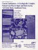
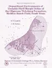
Canyon sandstones -- a geologically complex natural gas play in slope and basin facies, Val Verde basin, southwest Texas |
Hamlin, H.S., Clift, S.J., Dutton, S.P., Hentz, T.F., Laubach, S.E. |
1995 |
Report of Investigations |
|
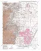
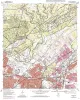
Geologic map of the Ranger Creek Quadrangle, Texas |
Collins, E.W. |
1995 |
Open-File Map |
|
Geologic map of the Waring quadrangle, Texas |
Collins, E.W. |
1995 |
Open-File Map |
|
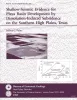
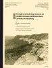
Shallow-seismic evidence for playa basin development by dissolution-induced subsidence on the southern High Plains, Texas |
Paine, J.G. |
1995 |
Report of Investigations |
|
The barite industry and resources of Texas |
Kyle, J.R. |
1994 |
Mineral Resource Circular |
|
Geologic map of the Sisterdale quadrangle, Texas |
Collins, E.W. |
1994 |
Open-File Map |
|
(Copublished with Colorado Geological Survey). Coalbed Methane in the Upper Cretaceous Fruitland Formation, San Juan Basin, New Mexico and Colorado |
Ayers Jr., W.B., Kaiser, W.R. |
1994 |
Report of Investigations |

|
Geologic map of the Kendalia Quadrangle, Texas |
Collins, E.W. |
1994 |
Open-File Map |
|
Geologic map of the Cavett Lake quadrangle, Texas |
Collins, E.W. |
1994 |
Open-File Map |
|
Depositional Environments of Unstable Shelf-Margin Deltas of the Oligocene Vicksburg Formation, McAllen Ranch Field, South Texas |
Langford, R.P., Combes, J.M. |
1994 |
Report of Investigations |
|
Geologic map of the North Franklin Mountain Quadrangle, Texas |
Raney, J.A., Collins, E.W. |
1994 |
Open-File Map |
|
With Colorado Geological Survey. Geologic and Hydrologic Controls on Coalbed Methane: Sand Wash Basin, Colorado and Wyoming |
Kaiser, W.R., Scott, A.R., Hamilton, D.S., Tyler, Roger, McMurry, R.G., Zhou, Naijiang, Tremain, C.M. |
1994 |
Report of Investigations |
|
GCAGS Transactions Volume 44 (1994) Austin |
|
1994 |
Gulf Coast Association of Geological Societies |
|
Quantifying secondary gas resources in fluvial/deltaic reservoirs: a case history from Stratton field, south Texas |
Levey, R.A., Finley, R.J., Sippel, M.A. |
1994 |
Report of Investigations |
|
Annual Report of the Bureau of Economic Geology 1994 |
University of Texas at Austin, Bureau of Economic Geology |
1994 |
Annual Reports |
|
Geologic map of the Longhorn quadrangle, Texas |
Collins, E.W. |
1994 |
Open-File Map |
|
Reservoir heterogeneity and permeability barriers in the Vicksburg S Reservoir, McAllen Ranch gas field, Hidalgo County, Texas |
Langford, R.P., Grigsby, J.D., Collins, R.E., Sippel, M.A., Wermund, E.G. |
1994 |
Report of Investigations |
|
Geologic map of the Castle Hills quadrangle, Texas |
Collins, E.W. |
1994 |
Open-File Map |
|
Impacts of Technology on the Global Gas Resource Base: Proceedings of the Global Gas Resources Workshop |
Ruthven, C.L. |
1994 |
Report of Investigations |
|
Use of dipmeters in stratigraphic and depositional interpretation of natural gas reservoirs of the Oligocene Vicksburg Formation: an example from McAllen Ranch field, Hidalgo County, Texas |
Langford, R.P., Hall, J.D., Howard, W.E. |
1994 |
Geological Circular |