|
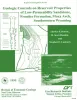
Boonsville 3-D Seismic Data Set |
Hardage, B.A., Simmons, J.L., Jr., Lancaster, D.E., Elphick, R.Y., Edson, R.D., Carr, D.L., Pendleton, V.M. |
1996 |
Seminars and Workshops |
|
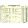
Lower Cenozoic Chronology of Gulf Chart, 1996. Two sheets in color with explanatory text on back of Sheet One |
|
1996 |
Gulf Coast Section SEPM |
|
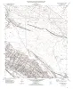
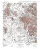
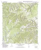
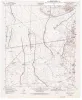
Geologic map of the Fort Hancock NW quadrangle, Texas |
Collins, E.W. |
1996 |
Open-File Map |
|
Chert reservoir development in the Devonian Thirtyone Formation: Three Bar field, West Texas |
Ruppel, S.C., Hovorka, S.D. |
1995 |
Report of Investigations |
|
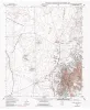
Geologic map of the Helms West Well Quadrangle, Texas |
Collins, E.W., Raney, J.A. |
1995 |
Open-File Map |
|
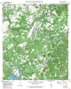
Geologic map of the Pipe Creek Quadrangle, Texas |
Collins, E.W. |
1995 |
Open-File Map |
|
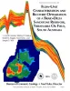
Flow-Unit Characterization and Recovery Optimization of a Braid-Delta Sandstone Reservoir, Tirrawarra Oil Field, South Australia |
Hamlin, H.S., Dutton, S.P., Seggie, R.J., Tyler, Noel, Yeh, J.S. |
1995 |
Report of Investigations |
|
Geologic map of the Hueco Tanks Quadrangle, Texas |
Collins, E.W., Raney, J.A. |
1995 |
Open-File Map |
|
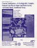
Canyon sandstones -- a geologically complex natural gas play in slope and basin facies, Val Verde basin, southwest Texas |
Hamlin, H.S., Clift, S.J., Dutton, S.P., Hentz, T.F., Laubach, S.E. |
1995 |
Report of Investigations |
|
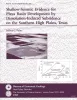
Shallow-seismic evidence for playa basin development by dissolution-induced subsidence on the southern High Plains, Texas |
Paine, J.G. |
1995 |
Report of Investigations |
|
Geologic map of the Ranger Creek Quadrangle, Texas |
Collins, E.W. |
1995 |
Open-File Map |
|
Geologic map of the Waring quadrangle, Texas |
Collins, E.W. |
1995 |
Open-File Map |
|
Geologic Controls on Reservoir Properties of Low-Permeability Sandstone, Frontier Formation, Moxa Arch, Southwestern Wyoming |
Dutton, S.P., Hamlin, H.S., Laubach, S.E. |
1995 |
Report of Investigations |
|
Geologic map of the Turkey Knob quadrangle, Texas |
Collins, E.W. |
1995 |
Open-File Map |
|
Geologic map of the Nations East Well quadrangle, Texas |
Collins, E.W. |
1995 |
Open-File Map |
|
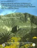
Sequence hierarchy and facies architecture of a carbonate-ramp system: San Andres Formation of Algerita Escarpment and western Guadalupe Mountains, West Texas and New Mexico |
Kerans, Charles, Fitchen, W.M. |
1995 |
Report of Investigations |
|
Geologic map of the Nations South Well quadrangle, Texas |
Collins, E.W. |
1995 |
Open-File Map |
|
Quaternary evolution of playa lakes on the southern High Plains -- a case study from the Amarillo area, Texas |
Hovorka, S.D. |
1995 |
Report of Investigations |
|
Catalogue, Bibliography, and Generic Revision of the Order Schizomida (Arachnida) |
|
1995 |
Texas Memorial Museum |
|
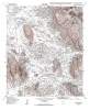
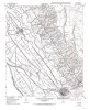
Geologic map of the Clint quadrangle, Texas |
Collins, E.W., Raney, J.A. |
1995 |
Open-File Map |