|
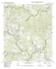
Geologic map of the Dripping Springs quadrangle, Texas |
Collins, E.W. |
2002 |
Open-File Map |
|
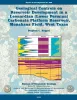
Geological controls on reservoir development in a Leonardian (Lower Permian) carbonate platform reservoir, Monahans field, West Texas |
Ruppel, S.C. |
2002 |
Report of Investigations |
|
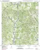
Geologic map of the Rafter Hollow quadrangle, Texas |
Collins, E.W. |
2002 |
Open-File Map |
|
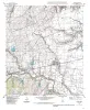
Geologic map of the Hutto Quadrangle, Texas |
Collins, E.W. |
2002 |
Open-File Map |
|
Geologic map of the Rough Hollow quadrangle, Texas |
Collins, E.W. |
2002 |
Open-File Map |
|
Geologic map of the Shingle Hills quadrangle, Texas |
Collins, E.W. |
2002 |
Open-File Map |
|
Geologic map of the Whitworth Ranch quadrangle, Texas |
Collins, E.W. |
2002 |
Open-File Map |
|
Texas Geologist and the Bureau of Economic Geology, 1949-1970 |
Flawn, P.T. |
2002 |
Udden Series |
|
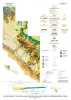
Geology and land use in the western part of the Gulf Coast coal-bearing region |
Warwick, P.D., Aubourg, C.E., Hook, R.W., SanFilipio, J.R., Barnes, V.E., Morrissey, E.A., Schultz, A.C., Karlsen, A.W., Watt, C.S., Podwysocki, S.M., Mercier, T.J., Wallace, W.C., Tully, J.K., Sun, Zhuang, Newton, Matthew |
2002 |
Miscellaneous Map |
|
Geologic map of the central Hueco Bolson, Acala - Fort Hancock - Esperanza region, Texas |
Collins, E.W., Raney, J.A. |
2002 |
Miscellaneous Map |
|
Geologic map of the Payton quadrangle, Texas |
Collins, E.W. |
2002 |
Open-File Map |
|
Geologic map of the Blanco quadrangle, Texas |
Collins, E.W. |
2002 |
Open-File Map |
|
GCAGS Transactions Volume 52 (2002) Austin |
|
2002 |
Gulf Coast Association of Geological Societies |
|
Geologic map of the Henly quadrangle, Texas |
Collins, E.W. |
2002 |
Open-File Map |
|
Geologic map of the Uhland quadrangle, Texas |
Collins, E.W. |
2002 |
Open-File Map |
|
Deep-Water Core Workshop, Northern Gulf of Mexico, 2002. CD-ROM |
|
2002 |
Gulf Coast Section SEPM |
|
Annual Report of the Bureau of Economic Geology 2002 |
University of Texas at Austin, Bureau of Economic Geology |
2002 |
Annual Reports |
|
Geologic map of the Martindale quadrangle, Texas |
Collins, E.W. |
2002 |
Open-File Map |
|
Geologic map of the Winchester quadrangle, Texas |
Collins, E.W. |
2001 |
Open-File Map |
|
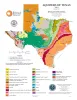
Aquifers of Texas |
Hovorka, S.D. |
2001 |
Thematic Maps |