|
Leaning Forward, A Memoir |
Fisher, W.L. |
2008 |
Udden Series |
|
Answering the Challenges of Production from Deep-Water Reservoirs |
|
2008 |
Gulf Coast Section SEPM |
|
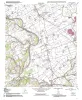
Geologic map of the Glenn Spring quadrangle, Big Bend National Park, Texas |
Collins, E.W., Muehlberger, W.R., Dickerson, P.W. |
2008 |
Miscellaneous Map |
|
Landscapes, Water, and Man |
|
2008 |
South Texas Geological Society |
|
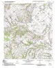
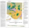
Geologic map of the Southeast Part of the Austin, Texas, 30x60 Minute Quadrangle; Central Texas Population Corridor Encompassing Bastrop and Smithville |
Collins, E.W. |
2008 |
Miscellaneous Map |
|
Sequence Stratigraphy and Depositional Systems of the Woodbine Group in East Texas Field: Core Workshop |
Ambrose, W.A., Hentz, T.F., Loucks, R.G., Clift, S.J., Potter, E.C., Bonnaffé, F. |
2008 |
Seminars and Workshops |
|
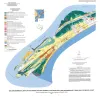
Canyon Dam Spillway Gorge, Comal County, Texas - Geologic and Hydrologic Issues |
Ward, William C., Molineux, Ann, Valentine, Shane, Woodruff, C.M., Jr. |
2008 |
Austin Geological Society |
|
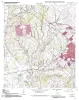
Geologic map of the Goodwill quadrangle, Texas |
Collins, E.W. |
2007 |
Open-File Map |
|
Geologic map of the Mumford quadrangle, Texas |
Collins, E.W. |
2007 |
Open-File Map |
|
Annual Report of the Bureau of Economic Geology 2007 |
University of Texas at Austin, Bureau of Economic Geology |
2007 |
Annual Reports |
|
Geologic map of the Tunis quadrangle, Texas |
Collins, E.W. |
2007 |
Open-File Map |
|
Geologic map of the Bryan West quadrangle, Texas |
Collins, E.W. |
2007 |
Open-File Map |
|
Reservoir Geology, Structural Architecture, and Sequence Stratigraphy of a Growth-Faulted Subbasin: Oligocene Lower Frio Formation, Red Fish Bay Area, South Texas Gulf Coast |
Hammes, Ursula, Loucks, R.G., Brown, L.F., Jr., Treviño, R.H., Montoya, Patricia, Remington, R.L. |
2007 |
Report of Investigations |
|
Geology of the Karnes Uranium District, Texas |
Cherepon, Alan J., Brandt, Jon E., Galloway, W.E. |
2007 |
Austin Geological Society |
|
Geologic map of the Del Rio, Texas, area |
Collins, E.W. |
2007 |
Miscellaneous Map |
|
Geoenvironmental map of southwest Bolivar Peninsula, Bolivar and Flake quadrangles, Texas Gulf of Mexico Coast |
Tremblay, T.A., White, W.A., Waldinger, R.L., Collins, E.W. |
2007 |
Open-File Map |
|
Reimers Ranch and Westcave Preserve, Landscapes, Water, and Lower Cretaceous Stratigraphy of the Pedernales Watershed, Western Travis County, Texas |
Hunt, B.B., Woodruff, C.M., Jr., Collins, E.W. |
2007 |
Austin Geological Society |
|
Geologic map of the Chances Store quadrangle, Texas |
Collins, E.W. |
2007 |
Open-File Map |
|
GCAGS Transactions Volume 57 (2007) Corpus Christi |
|
2007 |
Gulf Coast Association of Geological Societies |
|
Annual Report of the Bureau of Economic Geology 2006 |
University of Texas at Austin, Bureau of Economic Geology |
2006 |
Annual Reports |