|
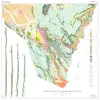
Geology of the Cave Creek School Quadrangle, Gillespie County, Texas |
Barnes, V.E. |
1967 |
Geologic Quadrangle Map |

|
Geology of the Monument Hill Quadrangle, Blanco County, Texas |
Barnes, V.E. |
1967 |
Geologic Quadrangle Map |

|
Geology of the Yeager Creek Quadrangle, Blanco and Hays Counties, Texas |
Barnes, V.E. |
1967 |
Geologic Quadrangle Map |

|
Geology of Presidio Area, Presidio County, Texas |
Dietrich, J.W. |
1966 |
Geologic Quadrangle Map |

|
Geology of Black Gap Area, Brewster County, Texas |
St. John, D.E. |
1966 |
Geologic Quadrangle Map |

|
Geology of the Hye Quadrangle, Blanco, Gillespie, and Kendall Counties, Texas |
Barnes, V.E. |
1965 |
Geologic Quadrangle Map |

|
Geology of the Rocky Creek Quadrangle, Blanco and Gillespie Counties, Texas |
Barnes, V.E. |
1965 |
Geologic Quadrangle Map |

|
Geology of the Stonewall Quadrangle, Gillespie and Kendall Counties, Texas |
Barnes, V.E. |
1965 |
Geologic Quadrangle Map |

|
Geology of the Johnson City Quadrangle, Blanco County, Texas |
Barnes, V.E. |
1963 |
Geologic Quadrangle Map |

|
Geology of the Eagle Mountains and Vicinity, Hudspeth County, Texas |
Underwood, J.R. |
1963 |
Geologic Quadrangle Map |

|
Geology of Eastern Half of Kent Quadrangle, Culberson, Reeves, and Jeff Davis Counties, Texas |
Brand, J.P., DeFord, R.K. |
1962 |
Geologic Quadrangle Map |

|
Geology of Van Horn Mountains, Texas |
Twiss, P.C. |
1959 |
Geologic Quadrangle Map |

|
Geology of the Pinto Canyon Area, Presidio County, Texas |
Amsbury, D.L. |
1958 |
Geologic Quadrangle Map |

|
Geologic map of Wylie Mountains and Vicinity, Culberson and Jeff Davis Counties, Texas |
Hay-Roe, Hugh |
1957 |
Geologic Quadrangle Map |

|
Geologic map of the Fall Prong Quadrangle, Kimble, Gillespie and Mason Counties, Texas |
Barnes, V.E. |
1956 |
Geologic Quadrangle Map |

|
Geologic map of the Threadgill Creek quadrangle, Gillespie and Kerr Counties, Texas |
Barnes, V.E. |
1954 |
Geologic Quadrangle Map |

|
Geologic map of the Wendel Quadrangle, Kimble, Kerr, and Gillespie Counties, Texas |
Barnes, V.E. |
1954 |
Geologic Quadrangle Map |

|
Geologic map of the Harper quadrangle, Gillespie County, Texas |
Barnes, V.E. |
1954 |
Geologic Quadrangle Map |

|
Geologic map of the Dry Branch quadrangle, Gillespie and Kerr Counties, Texas |
Barnes, V.E. |
1954 |
Geologic Quadrangle Map |

|
Geologic map of the Klein Branch quadrangle, Gillespie and Kerr Counties, Texas |
Barnes, V.E. |
1954 |
Geologic Quadrangle Map |