Publication Details
Publication Year
1967
Map Scale
1:250000
Publication Code
GA0031
Series
Geologic Atlas of Texas
Publisher
Geolocation:
Get the Publication
Available to Purchase:
$15.00
Abstract/Description:
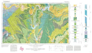
Geologic map that depicts the surface geology of Montague, Cooke, Grayson, Wise, Denton, and Collin Counties and parts of Jack, Fannin, Hunt, and Clay Counties, Texas. The 16-page booklet indicates geologic formations, abbreviations, and ages. The Sherman Sheet honors the late Walter Scott Adkins, distinguished Texas geologist, who was on the Bureau of Economic Geology staff from 1919 to 1921 and from 1926 to 1934. Mr. Adkins specialized in Cretaceous stratigraphy and paleontology and was internationally known for his contributions in these subjects.