Publications in Tyler
| Title | Publication Year Sort ascending | Abstract | Author | Series | Publisher | |
|---|---|---|---|---|---|---|
|
Environmental geology of the Yegua - Jackson lignite belt, southeast Texas | 1982 | Environmental geologic maps of the Texas lignite belt were prepared in response to renewed production of lignite in Texas and enactment of Federal and State laws governing coal and lignite surface mining. |
Jackson, M.L.W., Garner, L.E., Sharpe, R.D. | Report of Investigations | Bureau of Economic Geology |

|
Structural cross sections, Tertiary formations, Texas Gulf Coast | 1981 | The publication comprises 24 structural dip cross sections, spaced 15 to 20 mi apart along the Texas coast, and 4 structural strike cross sections. Dip sections extend from near the Wilcox outcrop to the coastline. |
Dodge, M.M., Posey, J.S. | Cross Sections | Bureau of Economic Geology |
|
Catahoula Formation of the Texas coastal plain: depositional systems, composition, structural development, ground-water flow history, and uranium distribution | 1977 | The Catahoula Formation of the Texas Gulf Coastal Plain consists of two depositional systems--the Gueydan bedload fluvial system of the Rio Grande embayment and the Chita-Corrigan mixed load fluvial system of the Houston embayment. |
Galloway, W.E., Murphy, T.D., Belcher, R.C., Johnson, B.D., Sutton, Stanley | Report of Investigations | Bureau of Economic Geology |
|
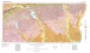
Geologic Atlas of Texas, Beaumont sheet (revised 1992) | 1968 | Geologic map that depicts the surface geology of Montgomery, San Jacinto, and Hardin Counties and parts of Madison, Trinity, Polk, Tyler, Jasper, Newton, Orange, Jefferson, Liberty, Harris, Waller, Grimes, Walker, and Robertson Counties. |
Barnes, V.E., Humble Oil and Refining Co., Shell Oil Co., Aronow, Saul, Shelby, C.A., Eargle, D.H., LeBlanc, R.J., Evans, F.G. | Geologic Atlas of Texas | Bureau of Economic Geology |
|
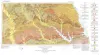
Geologic Atlas of Texas, Palestine sheet (revised 1993) | 1967 | Geologic map that depicts the surface geology of Nacogdoches, Shelby, San Augustine, Sabine, and Angelina Counties and parts of Anderson, Cherokee, Rusk, Newton, Jasper, Tyler, Polk, Trinity, Robertson, Madison, Leon, Freestone, and Panola Counties, Texas. |
Barnes, V.E., Humble Oil and Refining Co., Shell Oil Co., Pan American Petroleum Corp., Mobil Oil Co., Wright, A.C., McCallum, H.D., Wendlandt, E.A. | Geologic Atlas of Texas | Bureau of Economic Geology |
|
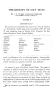
Rock and mineral resources of east Texas | 1965 | In the past 100 years, more than 100 names have been used to designate parts or all of the outcropping Midway and Wilcox rocks in the Gulf Coastal Plain; less than half of these names are used currently by Coastal Plain geologists, and the validity of some of the remaining named rock units has be |
Fisher, W.L., Chelf, C.R., Shelby, C.A., Garner, L.E., Owen, D.E., Shofield, D.A. | Report of Investigations | Bureau of Economic Geology |
|
Some Well Records in Tyler County Texas | 1929 | These circulars issued from the Bureau of Economic Geology contain the record of cores and cuttings from well received and described in the Bureau. |
Well Record | ||
|
The geology of east Texas | 1918 | Dumble, E.T. | UT Bulletin |