Miscellaneous Maps, Charts & Sections
-
Books & Reports
- Reports of Investigations
- Guidebooks
- Udden Series
- Geological Circulars
- Down To Earth
- Atlases of Major Oil and Gas Reservoirs
- Texas Memorial Museum Publications
- Environmental Geologic Atlas of the Texas Coastal Zone
- Mineral Resource Circulars
- Other Reports
- Seminars and Workshops
- Handbooks
- Submerged Lands of Texas
- Symposia
- Annual Reports
- Open File Reports
-
Maps & Cross Sections
- Thematic Maps
- Miscellaneous Maps, Charts & Sections
- Geologic Atlas of Texas
- STATEMAP Project Maps
- Geologic Quadrangle Maps
- Cross Sections
- Highway Geology Map
- Energy and Mineral Resource Maps
- Shoreline Change and Other Posters
- Wilcox Group, East Texas, Geological / Hydrological Folios
- Bouguer Gravity Atlas of Texas
- River Basin Regional Studies
- Featured Maps
- Posters
- Teachers & the Public
-
Geological Society Publications
- Gulf Coast Association of Geological Societies
- Alabama Geological Society
- Austin Geological Society
- Corpus Christi Geological Society
- Houston Geological Society
- Lafayette Geological Society
- Mississippi Geological Society
- New Orleans Geological Society
- South Texas Geological Society
- GCS SEPM Publications
- Historic BEG & UT Series
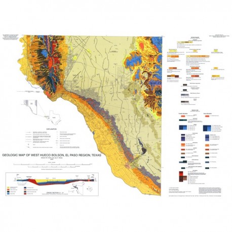
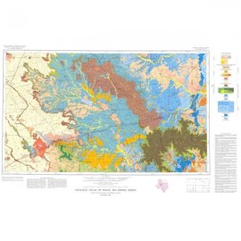
MM0040. Geologic Map of West Hueco Bolson, El Paso Region, Texas, by E. W. Collins and J. A. Raney. 1:100,000-scale color map, 25-p. text, 2000.
To order this oversize map and booklet as a PDF download, please order MM0040D.
About This Publication
This oversize, full-color map illustrates the physical geology of the Frankin Mountains, west side of the Hueco Mountains, Hueco Bolson piedmont and basin floor, and part of the Rio Grande valley. It includes the El Paso urban corridor and two major recreational areas, the Franklin Mountains and Hueco Tanks state parks. The text summarizes the area's geology and explains units depicted on the map. Map users include laypersons, students and teachers, and professional geologists, hydrologists, engineers, and urban planners.
Keywords: maps, Franklin Mountains, geologic maps, Hueco Bolson, Hueco Tanks, El Paso area, Rio Grande valley, Texas, West Texas
Citation
Collins, E. W., and Raney, J. A., 2000, Geologic Map of West Hueco Bolson, El Paso Region, Texas: The University of Texas at Austin, Bureau of Economic Geology, Miscellaneous Map No. 40, map scale 1:100,000, 25-p. text.

