Guidebooks
-
Books & Reports
- Reports of Investigations
- Guidebooks
- Udden Series
- Geological Circulars
- Down To Earth
- Atlases of Major Oil and Gas Reservoirs
- Texas Memorial Museum Publications
- Environmental Geologic Atlas of the Texas Coastal Zone
- Mineral Resource Circulars
- Other Reports
- Seminars and Workshops
- Handbooks
- Submerged Lands of Texas
- Symposia
- Annual Reports
- Open File Reports
-
Maps & Cross Sections
- Thematic Maps
- Miscellaneous Maps, Charts & Sections
- Geologic Atlas of Texas
- STATEMAP Project Maps
- Geologic Quadrangle Maps
- Cross Sections
- Highway Geology Map
- Energy and Mineral Resource Maps
- Shoreline Change and Other Posters
- Wilcox Group, East Texas, Geological / Hydrological Folios
- Bouguer Gravity Atlas of Texas
- River Basin Regional Studies
- Featured Maps
- Posters
- Teachers & the Public
-
Geological Society Publications
- Gulf Coast Association of Geological Societies
- Alabama Geological Society
- Austin Geological Society
- Corpus Christi Geological Society
- Houston Geological Society
- Lafayette Geological Society
- Mississippi Geological Society
- New Orleans Geological Society
- South Texas Geological Society
- GCS SEPM Publications
- Historic BEG & UT Series
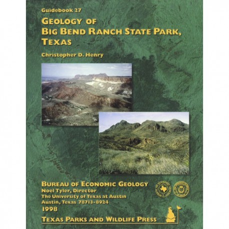
Geology of Big Bend Ranch State Park, Texas
GB0027
Geology of Big Bend Ranch State Park, Texas, by C. D. Henry. 72 p., 81 figs., 1 table, 1 oversize color geologic map in 2 sheets, 1998. ISSN: 0363-4132. Print
This richly illustrated, full-color guidebook and accompanying geologic map depict the long diverse and dynamic geologic history of Big Bend Ranch State Park. This park, the largest in the Texas State Parks System, lies in the rugged Big Bend region of West Texas. Its primary attraction is the scenery: the mountains, canyons, plateaus, river, and waterfalls. Every aspect of the natural landscape results from geologic processes of rock formation and erosion, such as mountain building, volcanism, and faulting. To aid the reader having little knowledge of geology, the guidebook also provides a complete glossary of geologic terms. Visitors to the park and general readers interested in Texas geology will find this guidebook to be a valued companion when exploring the varied West Texas landscape.
For an annotated folded map that is especially useful to hikers and campers, please see related item DE0003, Down to Earth at Big Bend Ranch State Park: Geologic Map and Trail-Side Geology.
Citation
Henry, C. D., 1998, Geology of Big Bend Ranch State Park, Texas: The University of Texas at Austin, Bureau of Economic Geology, Guidebook 27, 72 p.
