Geological Circulars
-
Books & Reports
- Reports of Investigations
- Guidebooks
- Udden Series
- Geological Circulars
- Down To Earth
- Atlases of Major Oil and Gas Reservoirs
- Texas Memorial Museum Publications
- Environmental Geologic Atlas of the Texas Coastal Zone
- Mineral Resource Circulars
- Other Reports
- Seminars and Workshops
- Handbooks
- Submerged Lands of Texas
- Symposia
- Annual Reports
- Open File Reports
-
Maps & Cross Sections
- Thematic Maps
- Miscellaneous Maps, Charts & Sections
- Geologic Atlas of Texas
- STATEMAP Project Maps
- Geologic Quadrangle Maps
- Cross Sections
- Highway Geology Map
- Energy and Mineral Resource Maps
- Shoreline Change and Other Posters
- Wilcox Group, East Texas, Geological / Hydrological Folios
- Bouguer Gravity Atlas of Texas
- River Basin Regional Studies
- Featured Maps
- Posters
- Teachers & the Public
-
Geological Society Publications
- Gulf Coast Association of Geological Societies
- Alabama Geological Society
- Austin Geological Society
- Corpus Christi Geological Society
- Houston Geological Society
- Lafayette Geological Society
- Mississippi Geological Society
- New Orleans Geological Society
- South Texas Geological Society
- GCS SEPM Publications
- Historic BEG & UT Series
Shoreline Changes on Mustang Island and North Padre Island (Aransas Pass to Yarborough Pass): An Analysis of Historical
GC7701
A free, digital version of this publication can be found on: Texas ScholarWorks
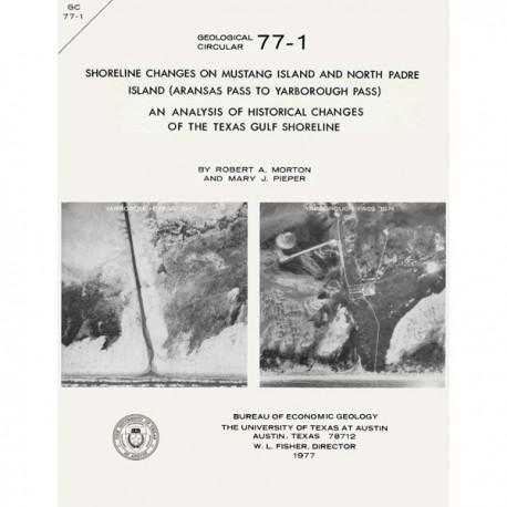
GC7701. Shoreline Changes on Mustang Island and North Padre Island (Aransas Pass to Yarborough Pass): An Analysis of Historical Changes of the Texas Gulf Shoreline, by R. A. Morton and M. J. Pieper. 45 p., 9 figs., 3 tables, 3 appendices, 1977. ISSN: 0082-3309. Print.
To purchase this publication as a PDF download, please order GC7701D.
ABSTRACT
Historical monitoring along Mustang and north Padre Islands records the nature and magnitude of changes in position of the shoreline and vegetation line and provides insight into the factors affecting those changes.
Documentation of changes is accomplished by the compilation of shoreline and vegetation line position from topographic maps, aerial photographs, and coastal charts of various vintages. Comparison of shoreline position based on topographic charts (dated 1860-82) and aerial photographs (taken in 1937, 1956-60, 1969-70, and 1974-75) indicates short-term changes of accretion and erosion along the Gulf shoreline between Aransas Pass and Yarborough Pass. Erosion produces a net loss in land, whereas accretion produces a net gain in land. Comparison of the vegetation line based on, the aforementioned aerial photographs indicates short-term cycles of retreat related to storms (primarily hurricanes) and recovery during intervening years of low storm incidence.
Long-term trend or direction of shoreline changes averaged over the 115-year time period of this study indicates that Mustang Island has experienced net erosion with two exceptions. Net accretion adjacent to Aransas Pass, which decreased from 1,600 feet near the south jetty to 350 feet about 2 miles south of the pass, was caused principally by inlet migration and concomitant outbuilding of the north end of the island prior to jetty construction in 1889. Net accretion also occurred about 1.5 miles north of the Nueces/Kleberg county line attendant with the infilling of Packery Channel. The remainder of Mustang Island recorded net erosion ranging from 75 to 350 feet and averaging 225 feet. Net rates of change, however, were low along Mustang Island except where net accretion ranged from approximately 3 feet per year to 14 feet per year. Net erosion on the island ranged from less than 1 foot per year to 3.8 feet per year and averaged 2.0 feet per year.
Net changes on north Padre Island were predominantly accretionary; however, net erosion was recorded from Packery Channel southward for a distance of about 7 miles. Minimum net erosion was 50 feet, whereas maximum net erosion was 500 feet, and average net erosion was 220 feet. The shoreline from 6.5 to 9 miles north of the Kleberg/Kenedy county line experienced only minor net changes of 25 feet or less. The remaining shoreline of north Padre Island experienced net accretion ranging from less than 10 feet to 275 feet; net accretion, which increased southward along the island, averaged 140 feet. Net rates of change were also low along north Padre Island. Net erosion ranged from less than 1 foot to 5.4 feet per year and averaged 2.0 feet per year. Similarly, net accretion varied from less than 1 foot to 3.0 feet and averaged 1.5 feet per year. Because of limitations imposed by the technique used, rates of change are subordinate to trends or direction of change. Furthermore, values determined for long-term net changes should be used in context. The values for rates of net change are adequate for describing long-term trends; however, rates of short-term changes may be of greater magnitude than rates of long-term changes, particularly in areas where both accretion and erosion have occurred.
Major and minor factors affecting shoreline changes include: (1) climate, (2) storm frequency and intensity, (3) local and eustatic sea-level conditions, (4) sediment budget, and (5) human activities. The major factors affecting shoreline changes along the Texas Coast, including Mustang and north Padre Islands, are relative sea-level conditions, compactional subsidence, and changes in sediment supply. Changes in position of the vegetation line are primarily related to storms.
Studies indicate that changes in shoreline and vegetation line on Mustang and north Padre Islands are largely the result of natural processes, perhaps expedited by man's activities. A basic comprehension of these physical processes and their effects is requisite to avoid or minimize physical and economic losses associated with development and use of the coast.
Keywords: shoreline change, Mustang Island, North Padre Island, Aransas Pass, Yarborough Pass, Texas, Texas Gulf Coast
Citation
Morton, R. A., and Pieper, M. J., 1977, Shoreline Changes on Mustang Island and North Padre Island (Aransas Pass to Yarborough Pass): An Analysis of Historical Changes of the Texas Gulf Shoreline: The University of Texas at Austin, Bureau of Economic Geology, Geological CIrcular 77-1, 45 p.
