Geological Circulars
-
Books & Reports
- Reports of Investigations
- Guidebooks
- Udden Series
- Geological Circulars
- Down To Earth
- Atlases of Major Oil and Gas Reservoirs
- Texas Memorial Museum Publications
- Environmental Geologic Atlas of the Texas Coastal Zone
- Mineral Resource Circulars
- Other Reports
- Seminars and Workshops
- Handbooks
- Submerged Lands of Texas
- Symposia
- Annual Reports
- Open File Reports
-
Maps & Cross Sections
- Thematic Maps
- Miscellaneous Maps, Charts & Sections
- Geologic Atlas of Texas
- STATEMAP Project Maps
- Geologic Quadrangle Maps
- Cross Sections
- Highway Geology Map
- Energy and Mineral Resource Maps
- Shoreline Change and Other Posters
- Wilcox Group, East Texas, Geological / Hydrological Folios
- Bouguer Gravity Atlas of Texas
- River Basin Regional Studies
- Featured Maps
- Posters
- Teachers & the Public
-
Geological Society Publications
- Gulf Coast Association of Geological Societies
- Alabama Geological Society
- Austin Geological Society
- Corpus Christi Geological Society
- Houston Geological Society
- Lafayette Geological Society
- Mississippi Geological Society
- New Orleans Geological Society
- South Texas Geological Society
- GCS SEPM Publications
- Historic BEG & UT Series
Depositional...and Hydrocarbon...Potential of the... Palo Duro and Dalhart Basins... Digital Download
GC8008D
For a print version: GC8008.
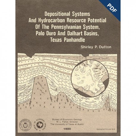
GC8008D. Depositional Systems and Hydrocarbon Resource Potential of the Pennsylvanian System, Palo Duro and Dalhart Basins, Texas Panhandle, by S. P. Dutton. 49 p., 42 figs., 3 tables, 1980. doi.org/10.23867/gc8008D. Downloadable PDF.
To purchase this publication in book format, please order GC8008.
ABSTRACT
Pennsylvanian clastic and carbonate strata were deposited in a variety of environments within the Palo Duro Basin. Maximum accumulation (totaling 750 m or 2,400 ft) occurred along a northwest-southeast axis. Major facies include fan-delta sandstone and conglomerate, shelf and shelf-margin carbonate, deltaic sandstone and shale, and basinal shale and fine-grained sandstone.
Erosion of Precambrian basement in the adjacent Amarillo and Sierra Grande Uplifts supplied arkosic sand (granite wash) to fan deltas along the northern margin of the basin. Distal fan-delta sandstones grade laterally and basinward into shallow-shelf limestone. Deep basinal shales were deposited only in a small area immediately north of the Matador Arch.
Increased subsidence deepened and enlarged the basin throughout late Pennsylvanian time. Ultimately, the basin axis trended east-west with a narrow northwest extension. A carbonate shelf-margin complex having 60 to 120 m (200 to 400 ft) of depositional relief developed around the basin margin. The eastern shelf margin remained stationary, but the western shelf margin retreated landward throughout late Pennsylvanian time. Porous, dolomitized limestone occurs in a belt 16 to 32 km (10 to 20 mi) wide along the shelf margin. High-constructive elongate deltas prograded into the Palo Duro Basin from the east during late Pennsylvanian time. Prodelta mud and thin turbidite sands entered the basin through breaks in the eastern carbonate shelf margin.
Potential hydrocarbon reservoirs are shelf-margin dolomite, fan-delta sandstone, and high-constructive delta sandstone. Basinal shales are fair to good hydrocarbon source rocks on the basis of total organic carbon content. Kerogen color and vitrinite reflectance data indicate that source beds may have reached the early stages of hydrocarbon maturation.
Keywords: depositional systems, hydrocarbons, oil and gas, resource potential, Pennsylvanian, Palo Duro Basin, Dalhart Basin, Texas Panhandle, Texas
CONTENTS
Abstract
Introduction
Objectives
Methods
Regional setting
Pre-Pennsylvanian history.
Tectonic activity
Pennsylvanian System
Lower Pennsylvanian strata
Fan-delta systems
Modern fan-delta model
Distribution of granite-wash lobes
Lower Pennsylvanian fan-delta facies
Marine shelf and basinal systems
Upper Pennsylvanian strata
Shelf-margin systems
Shelf-margin retreat
Deltaic and basinal systems
Pennsylvanian-Permian transition
Diagenesis and porosity distribution
Petroleum potential
Source rocks
Thermal maturity
Reservoirs and traps
Conclusions
Acknowledgments
References
ILLUSTRATIONS
Figures
1. Structural elements of the Texas Panhandle and location of study area
2. Index map of study area showing well control and locations of cross sections in this report
3. Stratigraphic chart and general lithology of the Palo Duro Basin
4. Isopach map of Cambrian (?) sandstone, which directly overlies Precambrian basement
5. Isopach map of Lower Ordovician Ellenburger Group
6. Isopach map of Mississippian System
7. Structure contour map drawn on the top of Precambrian basement
8. Isopach map of Pennsylvanian System
9. Structure contour map drawn on the top of the Pennsylvanian System
10. Classification of granite-wash sandstone samples, Cottle County, using Folk's (1974) classification
11. Isopach map of a granite-wash lobe and core locations in Cottle County
12. Location map of Liguanea gravel fan delta, Kingston, Jamaica, showing drowned spit and associated reefs
13. Typical electric log patterns of fan-delta facies, shallow marine shelf and shelf-margin facies, and deltaic facies
14. Net granite-wash map of lower Pennsylvanian System
15. East-west Pennsylvanian cross section A-A', from Bailey to Cottle Counties
16. East-west Pennsylvanian cross section B-B', from Parmer to Childress Counties
17. North south Pennsylvanian cross section F-F', from Donley to Floyd Counties
18. Upward-fining sequence in granite wash from Standard and Robinson #2 Tippen well, Cottle County
19. Crossbedding in granite wash, Standard Oil V1 Barron well, Cottle County
20. Brachiopod wackestone from Standard Oil # 1 Barron well, Cottle County
21. Net limestone map of lower part of the Pennsylvanian System
22. Schematic block diagram depicting the Palo Duro and Dalhart Basins in early Pennsylvanian time
23. Net granite-wash map of upper part of the Pennsylvanian System
24. Net carbonate map of upper part of the Pennsylvanian System
25. East-west Pennsylvanian cross section C-C', from Deaf Smith to Donley Counties
26. East-west Pennsylvanian cross section D-D', from Deaf Smith to Armstrong Counties
27. Schematic block diagram depicting Palo Duro and Dalhart Basins in late Pennsylvanian time
28. Net sandstone map of the upper Pennsylvanian System, including both granite wash and nonarkosic sandstone
29. East-west Pennsylvanian cross section E-E' through the Dalhart Basin from Dallam to Sherman Counties
30. Cross section G-G' in Cottle County through elongate-delta, bar finger sandstone
31. Block diagram of depositional environments in the modern Mahakam Delta and adjacent shelf, Indonesia
32. Matrix-supported, debris-flow conglomerate deposited in an upper submarine fan or feeder channel
33. Percent carbonate map of Wolfcampian strata showing position of Lower Wolfcampian shelf margins
34. Isopach map of upper Pennsylvanian dolomite based on sample log information
35. Isopach map of porous upper Pennsylvanian carbonate euhedral quartz overgrowths (Q) in Standard and Robinson #2Tippen well, Cottle County
36. Ferroan-dolomite (ankerite?) cement (F) with undulose extinction in Standard and Robinson #2 Tippen well, Cottle County
37. Secondary porosity (P) in Standard and Robinson #2Tippen well, Cottle County
38. Hydrocarbon shows from drill-stem tests and cuttings in Pennsylvanian carbonate, granite wash, and sandstone
39. Geothermal gradient map of Palo Duro and Dalhart Basins
40. Plot of total organic carbon (ToC) against depth for six wells having highest TOC values of Pennsylvanian samples
41. Distribution of total organic carbon in Pennsylvanian rocks of the Palo Duro Basin
42. Relation of kerogen color (thermal alteration index) and vitrinite reflectance values in Pennsylvanian source rocks to hydrocarbon facies
Tables
1. Wells used on cross sections in this report
2. Wells sampled for geochemical source-rock analyses
3. Reservoir potential of Pennsylvanian facies
Citation:
Dutton, S. P., 1980, Depositional Systems and Hydrocarbon Resource Potential of the Pennsylvanian System, Palo Duro and Dalhart Basins, Texas Panhandle: The University of Texas at Austin, Bureau of Economic Geology, Geological Circular 80-8, 49 p. doi.org/10.23867/gc8008D.
