Publications in Williamson
| Title | Publication Year Sort ascending | Abstract | Author | Series | Publisher | |
|---|---|---|---|---|---|---|
|
Guide to points of geologic interest in Austin | 1976 | Trippet, A.R., Garner, L.E. | Guidebook | Bureau of Economic Geology | |
|
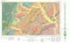
Geologic Atlas of Texas, Austin sheet | 1974 | Geologic map that depicts the surface geology of Burleson, Lee, Washington, and Brazos Counties and parts of Burnet, Bell, Milam, Robertson, Madison, Grimes, Waller, Austin, Fayette, Bastrop, Caldwell, Hays, Travis, and Williamson Counties. |
Barnes, V.E., Shell Oil Co., Humble Oil and Refining Co., Mobil Oil Co., Proctor, C.V., Jr., Brown, T.E., McGowen, J.H., Waechter, N.B. | Geologic Atlas of Texas | Bureau of Economic Geology |
|
Stratigraphy of Lower Cretaceous Trinity deposits of central Texas | 1971 | The stratigraphic record of the Lower Cretaceous Trinity Division in Central Texas, as revealed by extensive outcrop investigation, is that of a shallow sea transgressing the southern flank of the ancient Llano Uplift. |
Stricklin, F.L., Smith, C.I., Lozo, F.E. | Report of Investigations | Bureau of Economic Geology |
|
Nomenclature revision of basal Cretaceous rocks between the Colorado and Red Rivers, Texas | 1966 | Based on need for convenient, small-scale cartographic units, the basal Cretaceous rocks in Texas from Red River to Burnet County and on the Callahan Divide are herein divided into three distinctive lithologic sequences. |
Fisher, W.L., Rodda, P.U. | Report of Investigations | Bureau of Economic Geology |
|
Stratigraphy of the Fredericksburg Division, south-central Texas | 1964 | Sediments of the Fredericksburg Division in south-central Texas were deposited on the slowly subsiding west flank of the Tyler basin. In this region there are three stratigraphically distinct areas. The southern area has a thick Edwards Limestone unit overlying a thin Walnut Formation. |
Moore, C.H. | Report of Investigations | Bureau of Economic Geology |
|
Field excursion, eastern Llano region | 1958 | The first entry in the Guidebook Series details a field excursion to the Eastern Llano Region of Central Texas in 1958. Retrace the footsteps of Virgil Barnes and the other state geologists in attendance: Stop 1. Honeycut Bend |
Barnes, V.E. | Guidebook | Bureau of Economic Geology |
|
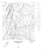
Geologic Maps, Central Texas (selected areas), 1957 and 1959 | 1957 | Fourteen black-and-white geologic maps prepared in 1957 and 1959 and obtained from the Department of Geological Sciences, University of Texas, and sold by the Bureau of Economic Geology. Geology compiled by F. L. Whitney; drafted by S. Espey, W. M. Strong, or W. L. Brooks; edited by K. P. |
Whitney, F.L. | Miscellaneous Map | Bureau of Economic Geology |
|
Building Stones of Central Texas | 1942 | Barnes, V.E., Dawson, R.F., Parkinson, G.A. | UT Publication | ||
|
Report on Gravel in Williamson County Texas | 1937 | The eastern part of Williamson County is in the black land belt of Texas where roads must be surfaced to be passable in wet weather. Road materials are scarce in this area, so much of the time spent on the mineral resource survey was concentrated on finding gravel. |
Leedy, D. | Mineral Resource Survey Circulars | |
|
Mineral Resources of Williamson County | 1929 | During the latter part of 1930, several wells were drilled into serpentine in the vicinity of Kimbro in Travis County. One of these, on the Allen farm, drilled in December 1930, is reported to have obtained oil in commercial quantities. |
Sellards, E.H. | Mineral Resource Pamphlet |