Publications in Williamson
| Title | Publication Year Sort ascending | Abstract | Author | Series | Publisher | |
|---|---|---|---|---|---|---|
|
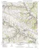
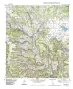
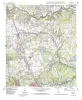
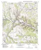
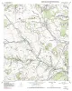
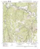
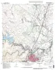
Geologic map of the Liberty Hill Quadrangle, Texas | 1999 | Collins, E.W. | Open-File Map | Bureau of Economic Geology | |
|
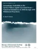
Groundwater availability in the Carrizo-Wilcox aquifer in central Texas -- numerical simulations of 2000 through 2050 withdrawal projections | 1999 | Between 1951 and 1996, groundwater pumpage from the Carrizo-Wilcox aquifer, one of Texas' major aquifer systems, increased in the area between the Colorado and Brazos Rivers from approximately 10,600 to 37,900 acre-ft/yr, primarily as a result of mining needs. |
Dutton, A.R. | Report of Investigations | Bureau of Economic Geology |
|
Geologic map of the Nameless Quadrangle, Texas | 1999 | Collins, E.W. | Open-File Map | Bureau of Economic Geology | |
|
Geologic map of the Leander Quadrangle, Texas | 1998 | Collins, E.W. | Open-File Map | Bureau of Economic Geology | |
|
Geologic map of the Leander NE Quadrangle, Texas | 1998 | Collins, E.W. | Open-File Map | Bureau of Economic Geology | |
|
Geologic map of the Florence quadrangle, Texas | 1998 | Collins, E.W. | Open-File Map | Bureau of Economic Geology | |
|
Geologic map of the Ding Dong Quadrangle, Texas | 1998 | Collins, E.W. | Open-File Map | Bureau of Economic Geology | |

|
Geologic map of the Youngsport Quadrangle, Texas | 1998 | Collins, E.W. | Open-File Map | Bureau of Economic Geology | |
|
Geologic map of the Georgetown quadrangle, Texas | 1997 | Collins, E.W. | Open-File Map | Bureau of Economic Geology | |
|
Geologic map of the Weir quadrangle, Texas | 1997 | Collins, E.W. | Open-File Map | Bureau of Economic Geology |