Publication Details
Geolocation:
Get the Publication
$10.00
Abstract/Description:
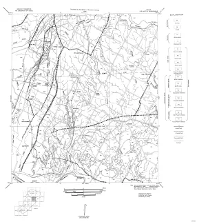
Fourteen black-and-white geologic maps prepared in 1957 and 1959 and obtained from the Department of Geological Sciences, University of Texas, and sold by the Bureau of Economic Geology. Geology compiled by F. L. Whitney; drafted by S. Espey, W. M. Strong, or W. L. Brooks; edited by K. P. Young.
Fourteen maps are included:
MM0016-A-Austin, NE (Travis and Williamson Counties)
MM0016-B-Austin, SW (Hays and Travis Counties)
MM0016-C-Bastrop (Travis County section)
MM0016-D-Blanco, SE (Hays County)
MM0016-E-Blanco, SW (Hays County)
MM0016-F-Boerne (Comal County section)
MM0016-G-Bracken (Comal County)
MM0016-H-Elgin (Travis and Williamson Counties)
MM0016-I-Hunter (Comal and Hays Counties)
MM0016-J-Leon Springs (Comal County section)
MM0016-K-New Braunfels (Comal County)
MM0016-L-San Marcos, NW (Hays County)
MM0016-M-Smithson Valley (Comal County)
MM0016-N-Spicewood (Hays and Travis Counties)