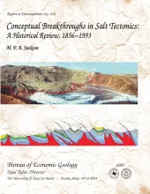
This report subjectively reviews the chief conceptual breakthroughs in understanding salt tectonics. Each discovery and its implications are presented as simply as possible. The history of salt tectonics divides naturally into three parts, defined here as the Pioneering Era, the Fluid Era, and the Brittle Era. The Pioneering Era (1856 to 1933) featured the search for a general hypothesis of salt diapirism, which was initially dominated by erroneous notions of igneous activity, residual islands, in situ crystallization, osmotic pressures, and expansive crystallization.
This volume comprises several short papers that review the results of the Bureau's State Lands Energy Resource Optimization (SLERO) project. By combining the information in the overview chapter with subsequent field-specific chapters, scientists, engineers, and oil and gas operators can find information applicable to nearly every major reservoir type in Texas.
Preface
Acknowledgments
Play Analysis and Resource Assessment of Texas State Lands — Mark H. Holtz; Chester M. Garrett, Jr.