Annual report for the Bureau of Economic Geology 1977
The objectives of this symposium [were] (1) to bring together individuals from universities and industry who have conducted research on Cretaceous carbonates, in order to accelerate communication, exchange ideas, and discuss differences of opinion; (2) to emphasize subsurface carbonate studies but to include outcrop investigations which provide insight into interpreting the subsurface; (3) to cover all aspects of carbonate studies--regional geological setting, facies and depositional environments, paleontology, and diagenesis.
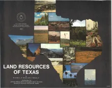
Texas is endowed with an enormous variety of natural land resources that vary from the humid forest lands of East Texas to the vast desert lands of Trans-Pecos, from the swamps and marshes of the Texas Coastal Zone to the arid plains of the Panhandle, and from the rich farmland of Central Texas to the sparsely vegetated sand plain of the south Texas coast. Almost 270,000 square miles of land, including plains, plateaus, mountains, hill country, beaches, river valleys, badlands, and many other types of terrain, comprise the natural land wealth of the State.
The Catahoula Formation of the Texas Gulf Coastal Plain consists of two depositional systems--the Gueydan bedload fluvial system of the Rio Grande embayment and the Chita-Corrigan mixed load fluvial system of the Houston embayment. Both systems contain distinctive fluvial channel-fill, crevasse splay, floodplain, and lacustrine facies, which tend to persist vertically through the section. The paleoclimate varied from subarid in the Gueydan system to humid in northeastern parts of the Chita-Corrigan system.