
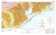
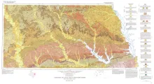
Geologic map that depicts the surface geology of Galveston and Chambers Counties and parts of Waller, Harris, Liberty, Jefferson, Orange, Brazoria, Matagorda, Wharton, and Fort Bend Counties. This Sheet was published as a memorial to the late Paul Weaver, distinguished Texas geologist and geophysicist, who was associated with Gulf Oil Corporation in Houston for many years and later with Texas A&M University. After retirement from Gulf in 1953, Mr. Weaver devoted his attention to water resources and conservation from both the humanitarian and scientific viewpoint.
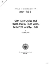
Paleoenvironmental analysis of the alternating beds of the basal Cretaceous Glen Rose Formation in Central Texas indicates a cyclical alternation of subtidal through supratidal facies. These facies were reconstructed through detailed analysis of lithology, biota (including macrofauna, microfauna, ichnofauna, and macroflora), detrital shell dispersal, and primary sedimentary structures. Facies succession indicates that each cycle represents a subtidal to supratidal depositional regime transit; cycles are regressional, with the transgressional phase being poorly developed, if at all.
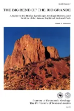
The scene is set. According to Indian legend, when the Great Creator made the earth and had finished placing the stars in the sky, the birds in the air, and the fish in the sea, there was a large pile of rejected stony materials left over. Finished with His job, He threw this into one heap and made the Big Bend. The rocks are strangely mixed up; most of the strata are lopsided or standing on end, and some of the mountains are turned upside down and piled where they do not appear to fit.
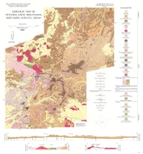
The Davis Mountains are an erosional remnant of a volcanic field that probably covered 5 to 10 times their present areal extent of approximately 2,000 square miles. Many previous workers believed that much of the extrusive material in nearby parts of western Trans-Pecos Texas was erupted from the central Davis Mountains (Colton, 1957, p. 76; Lewis, 1949, p. 89; McAnulty, 1955, p. 54<3; Zabriskie, 1951, p. 36).
Geologic map that depicts the surface geology of Nacogdoches, Shelby, San Augustine, Sabine, and Angelina Counties and parts of Anderson, Cherokee, Rusk, Newton, Jasper, Tyler, Polk, Trinity, Robertson, Madison, Leon, Freestone, and Panola Counties, Texas. This map was published in honor of Sidney Powers, who was one of the leading geologists of his generation and who was classed by many as the most proficient geologist in the oil industry before his death in 1932.