Publication Year
2021
Publisher
Series
Austin Geological Society
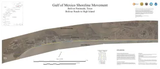
Publication Year
2021
Series
Posters
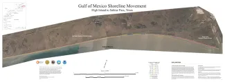
Publication Year
2021
Series
Posters
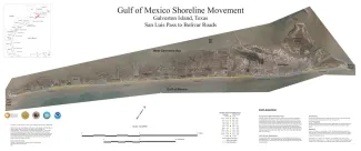
Publication Year
2021
Series
Posters
Publication Year
2021
Series
Posters