Oversize, color geologic maps on a topographic base, scale 1:24,000, depicting various geologic quadrangles in Texas, with informal text booklet, 1990's to the present
STATEMAP Project Maps
-

Lytton Springs Quadrangle, Caldwell... Lytton Springs Quadrangle, Caldwell...
$10.00Geologic Map of the Lytton Springs Quadrangle, Caldwell County, Texas by Woodruff, Jr., C.M., and Costard, L., 2021. Oversize geologic map on color topographic base, map scale 1:24,000, with explanatory text. Paper map. Digital Version.For a print version: OFM0253. Geologic Map of the Lytton Springs...
 In Stock
 -

Lytton Springs Quadrangle, Caldwell... Lytton Springs Quadrangle, Caldwell...
$20.00Geologic Map of the Lytton Springs Quadrangle, Caldwell County, Texas by Woodruff, Jr., C.M., and Costard, L., 2021. Oversize geologic map on color topographic base, map scale 1:24,000, with explanatory text. Paper map. Print Version.For a downloadable, digital version: OFM0253D. Geologic Map of the Lytton Springs...
In Stock -

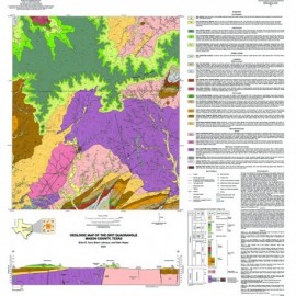
Grit Quadrangle, Mason County, Texas.... Grit Quadrangle, Mason County, Texas....
$10.00Geologic Map of the Grit Quadrangle, Mason County, Texas, by Hunt, B.B., Johnson, B., and Helper, M.. Two oversized geologic maps on a color topographic base, scale 1:24000. Digital Version.For a print version: OFM0252. Geologic Map of the Grit Quadrangle,...
In Stock -

Grit Quadrangle, Mason County, Texas Grit Quadrangle, Mason County, Texas
$30.00Geologic Map of the Grit Quadrangle, Mason County, Texas, by Hunt, B.B., Johnson, B., and Helper, M.. Two oversized geologic maps on a color topographic base, scale 1:24000. Print Version.For a downloadable, digital version: OFM0252D. Geologic Map of the Grit Quadrangle,...
In Stock -

Turtle Bay Quadrangle, Texas Gulf of... Turtle Bay Quadrangle, Texas Gulf of...
$10.00Geologic Map of the Turtle Bay Quadrangle, Texas Gulf of Mexico Coast by Paine, J.G., and Costard, L., 2021. 2 sheets, scale 1:24,000. Digital Version.For a print version: OFM0251. Geologic Map of the Turtle Bay...
In Stock -

Turtle Bay Quadrangle, Texas Gulf of... Turtle Bay Quadrangle, Texas Gulf of...
$30.00Geologic Map of the Turtle Bay Quadrangle, Texas Gulf of Mexico Coast by Paine, J.G., and Costard, L., 2021. 2 sheets, scale 1:24,000. Print Version.For a downloadable, digital version: OFM0251D. Geologic Map of the Turtle Bay...
In Stock -

Palacios and Part of the Palacios Point... Palacios and Part of the Palacios Point...
$10.00Geologic Map of the Palacios and Part of the Palacios Point Quadrangles, Texas Gulf of Mexico Coast by Paine, J.G., and Costard, L.. Two oversize geologic maps on a color topographic base, scale 1:24000. Digital Version.For a print version: OFM0250. Geologic Map of the Palacios and Part...
In Stock -

Palacios and Part of the Palacios Point... Palacios and Part of the Palacios Point...
$30.00Geologic Map of the Palacios and Part of the Palacios Point Quadrangles, Texas Gulf of Mexico Coast by Paine, J.G., and Costard, L.. Two oversize geologic maps on a color topographic base, scale 1:24000. Print Version.For a downloadable, digital version: OFM0250D. Geologic Map of the Palacios and Part...
In Stock -

Frozen Point and Caplen Quadrangles, Texas... Frozen Point and Caplen Quadrangles, Texas...
$10.00Geologic Map of the Frozen Point and Caplen Quadrangles, Texas Gulf of Mexico Coast by Caudle, T.L., and Paine, J. G.. Oversize geologic map on color topographic base, map scale 1:24,000. Digital Version.For a print version: OFM0249. Geologic Map of the Frozen Point and...
In Stock -

Frozen Point and Caplen Quadrangles, Texas... Frozen Point and Caplen Quadrangles, Texas...
$20.00Geologic Map of the Frozen Point and Caplen Quadrangles, Texas Gulf of Mexico Coast by Caudle, T.L., and Pain, J.G.. Oversize geologic map on color topographic base, map scale 1:24,000. Print Version.For a downloadable, digital version: OFM0249D. Geologic Map of the Frozen Point and...
In Stock -

Lake Stephenson and Smith Point... Lake Stephenson and Smith Point...
$10.00Geologic Map of the Lake Stephenson and Smith Point Quadrangles, Texas Gulf of Mexico Coast, by T. L. Caudle and J. G. Paine. 2020. Oversize geologic map on color topographic base, map scale 1:24,000. Digital Version.For a print version: OFM0248. Geologic Map of the Lake Stephenson...
In Stock -

Geologic Map of the Lake Stephenson and... Geologic Map of the Lake Stephenson and...
$20.00Geologic Map of the Lake Stephenson and Smith Point Quadrangles, Texas Gulf of Mexico Coast, by T. L. Caudle and J. G. Paine. 2020. Oversize geologic map on color topographic base, map scale 1:24,000. Print Version.For a downloadable, digital version: OFM0248D. Geologic Map of the Lake Stephenson...
In Stock