Geologic Maps Publications
|
Title |
Publication Year
Sort ascending
|
Abstract |
Author |
Series |
Publisher |
|
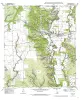
Geologic map of the D'hanis Quadrangle, Texas |
1998 |
|
Collins, E.W. |
Open-File Map |
Bureau of Economic Geology |
|
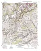
Geologic map of the Youngsport Quadrangle, Texas |
1998 |
|
Collins, E.W. |
Open-File Map |
Bureau of Economic Geology |

|
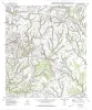
Geologic map of the Salado Quadrangle, Texas |
1998 |
|
Collins, E.W. |
Open-File Map |
Bureau of Economic Geology |
|
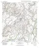
Geologic map of the Del Rio NE Quadrangle, Texas |
1998 |
|
Collins, E.W. |
Open-File Map |
Bureau of Economic Geology |
|
Geologic map of the Rough Canyon SE Quadrangle, Texas |
1998 |
|
Collins, E.W. |
Open-File Map |
Bureau of Economic Geology |
|
Geologic map of the Del Rio SE Quadrangle, Texas |
1998 |
|
Collins, E.W. |
Open-File Map |
Bureau of Economic Geology |
|
Geologic map of the Hondo quadrangle, Texas |
1998 |
|
Collins, E.W. |
Open-File Map |
Bureau of Economic Geology |
|
Geologic map of the Murphy School quadrangle, Texas |
1998 |
|
Collins, E.W. |
Open-File Map |
Bureau of Economic Geology |
|
Geologic map of the Mustang Valley Quadrangle, Texas |
1998 |
|
Collins, E.W. |
Open-File Map |
Bureau of Economic Geology |
|
Geologic map of the Lake Theo Quadrangle, Texas |
1998 |
|
Collins, E.W. |
Open-File Map |
Bureau of Economic Geology |