STATEMAP Project Maps
-
Books & Reports
- Reports of Investigations
- Guidebooks
- Udden Series
- Geological Circulars
- Down To Earth
- Atlases of Major Oil and Gas Reservoirs
- Texas Memorial Museum Publications
- Environmental Geologic Atlas of the Texas Coastal Zone
- Mineral Resource Circulars
- Other Reports
- Seminars and Workshops
- Handbooks
- Submerged Lands of Texas
- Symposia
- Annual Reports
- Open File Reports
-
Maps & Cross Sections
- Thematic Maps
- Miscellaneous Maps, Charts & Sections
- Geologic Atlas of Texas
- STATEMAP Project Maps
- Geologic Quadrangle Maps
- Cross Sections
- Highway Geology Map
- Energy and Mineral Resource Maps
- Shoreline Change and Other Posters
- Wilcox Group, East Texas, Geological / Hydrological Folios
- Bouguer Gravity Atlas of Texas
- River Basin Regional Studies
- Featured Maps
- Posters
- Teachers & the Public
-
Geological Society Publications
- Gulf Coast Association of Geological Societies
- Alabama Geological Society
- Austin Geological Society
- Corpus Christi Geological Society
- Houston Geological Society
- Lafayette Geological Society
- Mississippi Geological Society
- New Orleans Geological Society
- South Texas Geological Society
- GCS SEPM Publications
- Historic BEG & UT Series


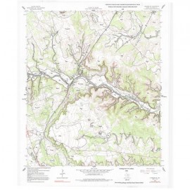
Geologic Map of Mansfield Dam, Jollyville, Austin West, and Bee Cave Quadrangles, Central Texas
OFM0237
For a downloadable, digital version: OFM0237D.
OFM0237. Geologic Map of Mansfield Dam, Jollyville, Austin West, and Bee Cave Quadrangles, Central Texas (Lower Lake Travis and Lake Austin Vicinity), by C. M. Woodruff, Jr., and E. W. Collins. 2018. Oversize geologic map on color topographic base, map scale 1:50,000. To purchase this map as a downloadable PDF, please order OFM0237D.
About This Publication
This geologic map encompasses four distinct areas within the Balcones Fault Zone west of Austin, an area experiencing rapid suburban growth with attendant pressures on the natural environment.
The following four areas are denoted by the interactions among bedrock, hydrologic processes, and resultant landforms:
(1) Relict uplands of the Jollyville Plateau and adjacent outlying ridges and hilltops constitute remnants of the once-continuous Edwards Plateau; these uplands are underlain chiefly by the Edwards Limestone and are locally pitted by karst features, thereby contributing recharge to the northern Edwards aquifer.
(2) Hilly terrain sculpted by erosion of the formerly continuous plateau uplands is characterized by high drainage density, steep slopes, and stepped terrain underlain mainly by the Glen Rose Limestone; this area, typical of the Central Texas Hill Country, is subject to flash flooding during heavy rains.
(3) The southeast corner of the map includes intensively faulted terrain that results in abrupt changes in substrate properties between limestone and claystone units; this area also includes Barton Springs, the main discharge site for this part of the downfaulted Edwards aquifer.
(4) The impounded course of the Colorado River includes the lower reaches of Lake Travis, all of Lake Austin, and upper reaches of Lady Bird Lake; water is the most important natural resource in the vicinity of this rapidly growing city, and Austin’s municipal water supply is obtained from two water-treatment plants on Lake Austin and a newer, larger treatment facility on Lake Travis.
This map provides a tool for predicting areas of stable ground for construction as well as sites of importance in the context of land resources such as scenic vistas, water-quality protection, wildlife habitat, and areas having educational value. In addition, the Balcones Escarpment region has the highest recurrence of flood-producing storms in the conterminous United States, subjecting valley bottoms and other lower slopes in this map area to periodic inundation. Land development may worsen flood impacts owing to increased runoff from impervious surfaces.
Keywords: Balcones Escarpment, Balcones Fault Zone, Barton Springs, Colorado River, maps, geologic maps, Ladybird Lake, Lake Austin, lower Lake Travis, Mansfield Dam area, Jollyville area, Austin West area, Bee Cave area, Central Texas, Travis County, Williamson County, Texas
Citation
Woodruff, C. M., Jr., and Collins, E. W., 2018, Geologic Map of Mansfield Dam, Jollyville, Austin West, and Bee Cave Quadrangles, Central Texas (Lower Lake Travis and Lake Austin Vicinity): The University of Texas at Austin, Bureau of Economic Geology, Open-File Map No. 237, map scale 1:50,000.