STATEMAP Project Maps
-
Books & Reports
- Reports of Investigations
- Guidebooks
- Udden Series
- Geological Circulars
- Down To Earth
- Atlases of Major Oil and Gas Reservoirs
- Texas Memorial Museum Publications
- Environmental Geologic Atlas of the Texas Coastal Zone
- Mineral Resource Circulars
- Other Reports
- Seminars and Workshops
- Handbooks
- Submerged Lands of Texas
- Symposia
- Annual Reports
- Open File Reports
-
Maps & Cross Sections
- Thematic Maps
- Miscellaneous Maps, Charts & Sections
- Geologic Atlas of Texas
- STATEMAP Project Maps
- Geologic Quadrangle Maps
- Cross Sections
- Highway Geology Map
- Energy and Mineral Resource Maps
- Shoreline Change and Other Posters
- Wilcox Group, East Texas, Geological / Hydrological Folios
- Bouguer Gravity Atlas of Texas
- River Basin Regional Studies
- Featured Maps
- Posters
- Teachers & the Public
-
Geological Society Publications
- Gulf Coast Association of Geological Societies
- Alabama Geological Society
- Austin Geological Society
- Corpus Christi Geological Society
- Houston Geological Society
- Lafayette Geological Society
- Mississippi Geological Society
- New Orleans Geological Society
- South Texas Geological Society
- GCS SEPM Publications
- Historic BEG & UT Series

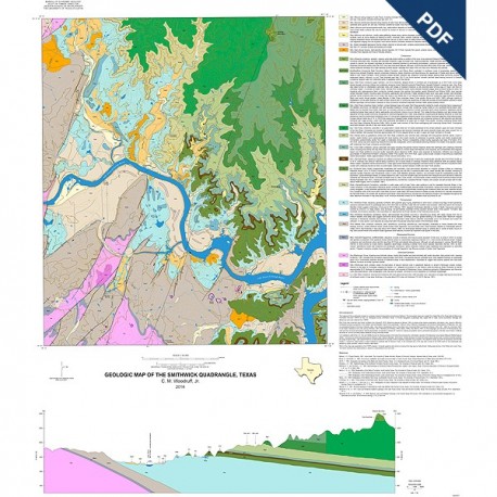
OFM0216D. Geologic map of the Smithwick quadrangle, Texas, by C. M. Woodruff, Jr. Oversize geologic map on a color topographic base, map scale 1:24,000, 2014. Downloadable PDF. For a paper map: OFM0216.
About This Publication
The Smithwick Quadrangle of Burnet County straddles the Colorado River along the impounded upper reaches of Lake Travis. Quaternary alluvial deposits (sand, gravel, silt, and clay) occur as terraces above lake level and as discontinuous valley deposits along tributary streams. The map shows a major unconformity between Cretaceous and Paleozoic strata. Cretaceous units in this area include: Sycamore Sand, Hammett Shale, Cow Creek Limestone, Hensel Sand, Glen Rose Limestone, discontinuous Paluxy Sand, Walnut Formation, Comanche Peak Limestone, and Edwards Limestone. Pennsylvanian strata (Smithwick Shale, Smithwick Sandstone, and Marble Falls Limestone) directly underlie the Cretaceous section. In places, these Paleozoic rock units are displaced by normal faults that trend northeast–southwest and locally juxtapose the upper Paleozoic strata against lower Paleozoic units (Ordovician Ellenburger Group and Cambrian San Saba Limestone).
Keywords: Burnet County, maps, geologic maps, Smithwick Quadrangle, Sycamore Sand, Hammett Shale, Cow Creek Limestone, Hensel Sand, Glen Rose Limestone, Paluxy Sand, Walnut Formation, Comanche Peak Limestone, Edwards Limestone. Pennsylvanian, Smithwick Shale, Smithwick Sandstone, Marble Falls Limestone, Texas
Citation
Woodruff, C. M., Jr., 2014, Geologic Map of the Smithwick Quadrangle, Texas: The University of Texas at Austin, Bureau of Economic Geology, Open-File Map No. OFM0216, map scale 1:24,000.
