Reports of Investigations
-
Books & Reports
- Reports of Investigations
- Guidebooks
- Udden Series
- Geological Circulars
- Down To Earth
- Atlases of Major Oil and Gas Reservoirs
- Texas Memorial Museum Publications
- Environmental Geologic Atlas of the Texas Coastal Zone
- Mineral Resource Circulars
- Other Reports
- Seminars and Workshops
- Handbooks
- Submerged Lands of Texas
- Symposia
- Annual Reports
- Open File Reports
-
Maps & Cross Sections
- Thematic Maps
- Miscellaneous Maps, Charts & Sections
- Geologic Atlas of Texas
- STATEMAP Project Maps
- Geologic Quadrangle Maps
- Cross Sections
- Highway Geology Map
- Energy and Mineral Resource Maps
- Shoreline Change and Other Posters
- Wilcox Group, East Texas, Geological / Hydrological Folios
- Bouguer Gravity Atlas of Texas
- River Basin Regional Studies
- Featured Maps
- Posters
- Teachers & the Public
-
Geological Society Publications
- Gulf Coast Association of Geological Societies
- Alabama Geological Society
- Austin Geological Society
- Corpus Christi Geological Society
- Houston Geological Society
- Lafayette Geological Society
- Mississippi Geological Society
- New Orleans Geological Society
- South Texas Geological Society
- GCS SEPM Publications
- Historic BEG & UT Series

Regional and Local Variability in Lowstand Valley Fill and Deltaic Deposits in the Tannehill Sandstone...Permian Basin
RI0290
Regional and Local Variability in Lowstand Valley Fill and Deltaic Deposits in the Tannehill Sandstone (Cisco Group), Eastern Shelf of the Permian Basin by W.A. Ambrose, T.F. Hentz, H. Rogers, and D.L. Carr. 48p. 2024. Print Version
For a downloadable, digital version: RI0290D
doi.org/10.23867/RI0290D
Abstract:
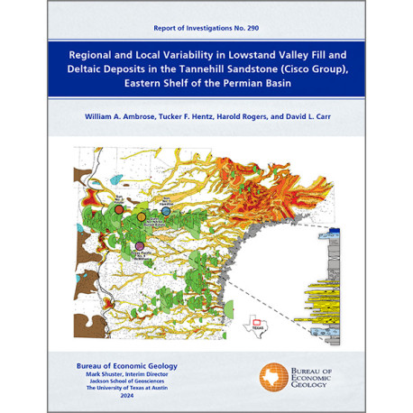
Lowstand valley fill and shelf-edge deltaic deposits in the Tannehill sandstone (Wolfcampian Cisco Group) in the Eastern Shelf of the Permian Basin are major targets for oil and gas exploration. The most-productive trends link coarse-grained alluvial systems in Baylor County to shelf-edge and upper-slope deepwater systems in Dickens County.
Depositional axes in the Tannehill sandstone in the updip (eastern) facies tract in Wichita, Archer, Clay, and Montague Counties, proximal to sediment source areas in the Ouachita fold belt and the Arbuckle Mountains, contain 40 to 80 ft (12–24 m) of net sandstone in complex and anastomosing patterns that record coarse-grained braided channel systems. Outcrops contain coarse-grained incised valley fill deposits in erosional contact with underlying carbonates in transgressive systems tracts.
Tannehill fluvial depositional axes west of the outcrop belt and east of the Saddle Creek shelf edge are confined to narrow (2–5-mi-wide [<3.2–8.0 km]), moderately sinuous belts with 10 to 40 ft (3–12 m) of net sandstone. These depositional axes represent two types of depositional systems. Depositional axes with tributary patterns that extend to the shelf edge are lowstand, incised valley fill deposits. Cores in these incised valley fill systems contain coarse-grained, fluvial channel fill sandstones in erosional contact with transgressive carbonate deposits. These channel fill sandstones grade upward into muddy, abandoned channel fill and floodplain deposits with paleosols. These deposits are in turn overlain by nonporous transgressive carbonates that record marine flooding of the Tannehill valley fill succession. A second trend of depositional axes between the outcrop belt and the Saddle Creek shelf edge displays westward-bifurcating net sandstone patterns, many of which terminate east of the shelf edge. These net sandstone patterns represent slightly younger highstand deltaic deposits.
Tannehill valley fill systems along the eastern margin of the Saddle Creek shelf edge are dominated by estuarine deposits. Tannehill estuarine sandstones in western King County, approximately 20 mi (~32 km) east of the Saddle Creek shelf edge, contain tidal stratification consisting of bidirectional ripples and thin (millimeter-scale) cyclic mudstone drapes. Tannehill estuarine deposits contain shallow-marine ichnofauna with Planolites, Schaubcylindrichnus, and Conichnus.
The Tannehill sandstone in Nolan, Taylor, Coke, and Runnels Counties occurs in two trends: (1) narrow (1–5-mi-wide [1.6–8.0 km]), slightly curvilinear belts extending westward and southwestward to the Stockwether shelf edge and (2) local, digitate depositional patterns updip (eastward) of the Stockwether shelf edge. Trend 1 represents lowstand valley fill systems that locally incise the Saddle Creek Limestone. These valley fill deposits are 20 to 50 ft thick (6–15 m), have blocky to upward-fining wireline-log responses with consistently low resistivity values, high (negative) spontaneous potential responses, and low gamma-ray values. Trend 2 is composed of slightly younger highstand deltaic deposits updip (east) of the Saddle Creek shelf edge.
The value of this study for oil and gas exploration in the Tannehill sandstone is threefold: it (1) extends previous work depicting the distribution of lowstand valley fill and deltaic systems at both regional and local scales, (2) adds core control and provides interpretations of facies in nonmarine, marginal-marine, and shallow-marine deposits, enabling reconstruction of the depositional history, and (3) provides an exploration framework and geologic context for the various Tannehill producing fields and trends as well other areas in the Eastern Shelf with potential for additional oil and gas production.
Citation:
Ambrose, W. A., Hentz, T. F., Rogers, H., and Carr, D. L., 2024, Regional and local variability in lowstand valley fill and deltaic deposits in the Tannehill sandstone (Cisco Group), Eastern Shelf of the Permian Basin: The University of Texas at Austin, Bureau of Economic Geology Report of Investigations No. 290, 48 p.
