Reports of Investigations
-
Books & Reports
- Reports of Investigations
- Guidebooks
- Udden Series
- Geological Circulars
- Down To Earth
- Atlases of Major Oil and Gas Reservoirs
- Texas Memorial Museum Publications
- Environmental Geologic Atlas of the Texas Coastal Zone
- Mineral Resource Circulars
- Other Reports
- Seminars and Workshops
- Handbooks
- Submerged Lands of Texas
- Symposia
- Annual Reports
- Open File Reports
-
Maps & Cross Sections
- Thematic Maps
- Miscellaneous Maps, Charts & Sections
- Geologic Atlas of Texas
- STATEMAP Project Maps
- Geologic Quadrangle Maps
- Cross Sections
- Highway Geology Map
- Energy and Mineral Resource Maps
- Shoreline Change and Other Posters
- Wilcox Group, East Texas, Geological / Hydrological Folios
- Bouguer Gravity Atlas of Texas
- River Basin Regional Studies
- Featured Maps
- Posters
- Teachers & the Public
-
Geological Society Publications
- Gulf Coast Association of Geological Societies
- Alabama Geological Society
- Austin Geological Society
- Corpus Christi Geological Society
- Houston Geological Society
- Lafayette Geological Society
- Mississippi Geological Society
- New Orleans Geological Society
- South Texas Geological Society
- GCS SEPM Publications
- Historic BEG & UT Series
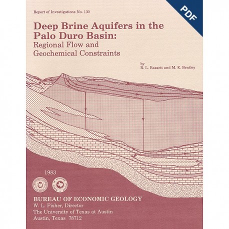
Deep Brine Aquifers in the Palo Duro Basin:... Digital Download
RI0130D
A free, digital version of this publication can be found on: Texas ScholarWorks
To purchase a print version (if available): RI0130
RI0130D. Deep Brine Aquifers in the Palo Duro Basin: Regional Flow and Geochemical Constraints, by R. L. Bassett and M. E. Bentley, assisted by E. A. Duncan. 59 p., 42 figs., 7 tables, 3 appendices, 1983. doi.org/10.23867/RI0139D. Downloadable PDF.
To purchase this publication in book format, please order RI0130.
ABSTRACT
Geologic characterization of evaporite deposits as potential host rocks for burial of radioactive waste must include hydrogeologic investigations at both local and regional scales. The Palo Duro and Dalhart Basins of Texas contain candidate salt deposits that are underlain by shelf carbonates and fan-delta sandstones. These basins are ancient intracratonic elements exhibiting regional eastward flow in the deep brine aquifers. Pressures in these aquifers are "subnormal"; however, the major component of flow appears to be parallel to bedding, owing to the low permeability of the overlying evaporite strata in the central part of the basin.
Salinity values computed from geophysical logs or obtained from chemical analyses indicate only small aberrations from a regional average salinity for brines in carbonate rocks and sandstones of Late Pennsylvanian and Early Permian age. Brine composition is derived by reaction with the host rock, obtaining salinity primarily from evaporite facies and, at present, apparently follows the calcite phase boundary. Brines may also be near equilibrium with anhydrite except in regions where sulfate reduction has generated hydrogen sulfide. Evidence of ion exchange is tenuous; however, clastic sediments predominate in the western part of the basin, early in the flow path, and a significant reduction in the molar ratio of sodium to chloride is observed in many samples. Substantial outgassing of carbon dioxide (CO2) and oxidation of ferrous iron appear to have occurred as the samples were collected by industry during wildcat drilling. Mass transfer computer programs have been used to determine the most probable in situ brine composition. Support for the validity of the computed equilibrium state is the correlation between the values of partial pressure of carbon dioxide (Pco,) calculated for the brines and the PCO2 observed in adjacent natural gas reservoirs.
Keywords: aquifers, computer modeling, drill-stem-test analysis, Early Permian, geochemistry, hydrogeology, Late Pennsylvanian, nuclear waste, Palo Duro Basin, Permian Basin, Texas
CONTENTS
ABSTRACT
INTRODUCTION
HYDROGEOLOGIC FRAMEWORK
HYDROLOGY OF THE DEEP-BASIN FLOW SYSTEM
Sources of Hydraulic Data
Hydrodynamics
COMPOSITION OF DEEP-BASIN BRINES
Sources of Chemical Data
Geophysical Data and Regional Salinity
GEOCHEMICAL CONSTRAINTS ON THE BRINE ENVIRONMENT
Defining Reactions and Chemical Composition
Thermodynamic Data and Computations
Mass Transfer in the Carbonate System
CONCLUSIONS
ACKNOWLEDGMENTS
REFERENCES
APPENDIX A: Horner Plots for Wolfcamp Carbonates
APPENDIX B: Chemical Composition of Formation Brines
APPENDIX C: Determination of Resistivity (Salinity) from Spontaneous Potential Logs
Figures
1. Location of study area and cross sections
2. East-west cross section showing stratigraphic framework and depositional systems of Pennsylvanian-Lower Permian strata
3. Net-sandstone map of Wolfcampian Series
4. Percent carbonate map of Lower Permian Wolf camp strata
5. Regional east-west cross section illustrating spatial relations among the major depositional systems in the Palo Duro Basin
6. Hydraulic head map, Wolfcamp aquifer, Texas Panhandle
7. Frequency distribution of the effective permeability in Wolfcamp carbonates determined by analysis of 19 drill-stem-test charts
8. Regional east-west section approximately parallel to flow, illustrating the distribution of major hydrogeologic units and their corresponding relative permeabilities
9. Location map showing (1) the Pco2 of oil and gas fields computed from analyses of gas samples, and (2) Pco2 computed from analytical results obtained from brine in wildcat and production wells
10. Contour lines showing carbonate isoliths for the Wolfcampian-age section of the deep-basin brine aquifer
11. Contour lines showing isopachous map of granite wash in the deep-basin brine aquifer
12. Trilinear diagram illustrating the compositional variation of brine samples from the Permian Wolfcamp carbonate aquifer
13. Trilinear diagram illustrating the compositional variation of brine samples from the Pennsylvanian-Permian granite-wash facies
14. Saturation state of brine samples from the granite-wash facies as computed with AQISALT
15. Saturation state of brine samples from Wolfcamp carbonate facies as computed with AQISALT
16. Sodium to chloride ratio in granite-wash facies shifting away from that typical of halite dissolution, followed by ion exchange
17. Sodium to chloride ratio in brine samples from Wolf camp carbonates
18. Saturation states computed with AQISALT and SOLMNEQ for Wolfcamp carbonate brines, the effect of outgassing of CO2, and the oxidation of dissolved iron
19. Saturation state of Wolfcamp carbonate brine with respect to dolomite as computed with AQISALT and SOLMNEQ
20. Distribution of CO2 partial pressure in oil and gas fields in the Palo Duro and Dalhart Basins
21. Computed saturation states for brines within the Palo Duro and Dalhart Basins using the reported pH values
22. Theoretical behavior of the computed saturation index with respect to pH accompanying mass transfer of CO2
23. Computed saturation states for Wolf camp carbonate brines from Sherman County, illustrating the effect of CO2loss and iron oxidation
A1--A19. Semilog plots of pressure buildup with time (using the Horner method) for wells in the Palo Duro Basin
Tables
1. Generalized stratigraphic column, depositional environment, and general hydrologic properties, Palo Duro Basin
2. Chemical composition and computed equilibrium conditions for brine samples within the Palo Duro and Dalhart Basins
3. Compositions of hypothetical brine in equilibrium with calcite for computations of changes in the saturation state with CO2 outgassing
A·1. Hydraulic parameters derived from an analysis of drill-stem-test charts using the Horner method
B-1. Chemical composition of brines collected from wells penetrating the Wolfcamp deep-basin aquifer
C-1. Estimates of TDS (salinity) in the Wolfcamp deep-basin aquifer obtained from analysis of spontaneous potential
C-2. Estimates of TDS (salinity) in the granite-wash deep-basin aquifer obtained from analysis of spontaneous potential logs
Citation
Bassett, R. L., and Bentley, M. E., 1983, Deep Brine Aquifers in the Palo Duro Basin: Regional Flow and Geochemical Constraints: The University of Texas at Austin, Bureau of Economic Geology, Report of Investigations No. 130, 59 p.

