Reports of Investigations
-
Books & Reports
- Reports of Investigations
- Guidebooks
- Udden Series
- Geological Circulars
- Down To Earth
- Atlases of Major Oil and Gas Reservoirs
- Texas Memorial Museum Publications
- Environmental Geologic Atlas of the Texas Coastal Zone
- Mineral Resource Circulars
- Other Reports
- Seminars and Workshops
- Handbooks
- Submerged Lands of Texas
- Symposia
- Annual Reports
- Open File Reports
-
Maps & Cross Sections
- Thematic Maps
- Miscellaneous Maps, Charts & Sections
- Geologic Atlas of Texas
- STATEMAP Project Maps
- Geologic Quadrangle Maps
- Cross Sections
- Highway Geology Map
- Energy and Mineral Resource Maps
- Shoreline Change and Other Posters
- Wilcox Group, East Texas, Geological / Hydrological Folios
- Bouguer Gravity Atlas of Texas
- River Basin Regional Studies
- Featured Maps
- Posters
- Teachers & the Public
-
Geological Society Publications
- Gulf Coast Association of Geological Societies
- Alabama Geological Society
- Austin Geological Society
- Corpus Christi Geological Society
- Houston Geological Society
- Lafayette Geological Society
- Mississippi Geological Society
- New Orleans Geological Society
- South Texas Geological Society
- GCS SEPM Publications
- Historic BEG & UT Series
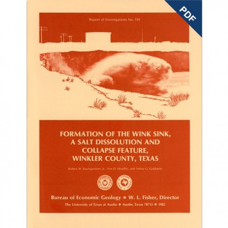
Formation of the Wink Sink..., Winkler County, Texas. Digital Download
RI0114D
A free, digital version of this publication can be found on: Texas ScholarWorks
To purchase a print version (if available): RI0114
RI0114D. Formation of the Wink Sink, A Salt Dissolution and Collapse Feature, Winkler County, Texas, by R. W. Baumgardner, Jr. A. D. Hoadley, and A. G. Goldstein. 38 p., 22 figs., 5 tables, 1982. doi.org/10.23867/RI0114D. Downloadable PDF.
To purchase this publication in book format, please order RI0114.
ABSTRACT
The Wink Sink in Winkler County, Texas, formed on June 3, 1980. Within 24 hours it had expanded to a maximum width of 360 ft (110 m). On June 5, 1980, maximum depth of the sinkhole was 110 ft (34 m), and volume about 5.6 million ft3 (158,600 m3). Between June 3 and June 6, 1980, a large area bordering the south rim of the sink subsided about 10 ft (3 m) relative to the north side. Further subsidence of 1,456 ft (44.4 cm) occurred along the southern rim between July 19 and December 12, 1980.
A probable precursor of the sinkhole was a solution cavity that migrated upward by successive roof failures, thereby producing a collapse chimney filled with brecciated rock. Dissolution of salt in the Permian Salado Formation is inferred to have produced the solution cavity. Depth of the Salado ranges from 1,300 to 2,200 ft (396 to 670 m). Data on the size and initial depth of the solution cavity are unavailable.
The Salado Formation in the region contains several dissolution zones. Occurrence of dissolution in the middle of the Salado evaporite sequence may have resulted from groundwater flow along fractured anhydrite interbeds. Water may have come in contact with salt by downward movement from overlying aquifers or by upward movement from underlying aquifers under artesian pressure.
The Wink Sink lies directly above the Permian Capitan Reef, which contains water that is unsaturated with respect to sodium chloride. Hydraulic head of water from the reef is higher than the elevation of the Salado Formation but lower than the head in the Triassic Santa Rosa Formation, a near-surface fresh-water aquifer. Fracture or cavernous permeability occurs above, within, and below the Salado Formation, as indicated by the loss of circulation of drilling fluid in wells drilled near the sinkhole. Consequently, a brine density-flow cycle may be operating: relatively fresh water moves upward under artesian pressure and dissolves salt; the denser brine moves downward under gravity flow in the same fracture system. Alternatively, downward flow of water from aquifers such as the Santa Rosa Formation or Quaternary sediments above the salt is also a possible explanation for dissolution. A plugged and abandoned well that was located within the circumference of the sinkhole may have provided a conduit for water movement.
Composition of water in the Wink Sink resembles that of water in nearby wells producing from the Quaternary alluvium and from the Triassic Santa Rosa Formation.
Hendrick well number 10-A was drilled in 1928 at a site now within the circumference of the sinkhole. The well, which initially produced about 80 percent water from the Permian Tansill Formation, was plugged with cement and abandoned in 1964. The well was not used for brine disposal. Over 12 million barrels of salt water produced from the Hendrick Field were disposed of by injection into the Permian Rustler Formation during 1961. Waterflood projects in the Hendrick Field began in 1963 and are still in progress.
Sinkholes similar to the Wink Sink occur in other areas of North America. Their morphology, associated strata, and mode of formation suggest that dissolution, brecciation, and surface subsidence commonly occur during their formation.
Keywords: salt (halite) dissolution, Permian Salado Formation, Capitan Reef, Triassic, Santa Rosa Formation, collapse sinkhole, abandoned oil well, sinkholes, West Texas, Winkler County, Wink Sink, Texas
CONTENTS
ABSTRACT
INTRODUCTION
REGIONAL GEOLOGIC SETTING
Surficial geology
Stratigraphy
Structural geology
SALT DISSOLUTION IN THE DELAWARE BASIN
History of salt dissolution
Mechanisms of salt dissolution
Brine-density flow
Downward ground-water flow
Dissolution phenomena in the Delaware Basin
Collapse features
Pecos River salt load
DEVELOPMENT OF THE WINK SINK
Mechanisms of dissolution
Local geologic setting
Stratigraphy and structural geology
Gravity survey
First-order leveling survey
Hydrology of the Wink
Water-level changes
Water chemistry
HISTORY OF HENDRICK WELL NUMBER 10-A
BRINE PRODUCTION AND INJECTION
SUBSIDENCE FEATURES IN WESTERN WINKLER COUNTY
SINKHOLES IN OTHER AREAS
CONCLUSIONS
ACKNOWLEDGMENTS
REFERENCES
APPENDIX A. DESCRIPTION OF STRATIGRAPHIC UNITS
APPENDIX B. WELLS CITED IN THE TEXT
APPENDIX C. CHANGES IN SURFACE ELEVATION AT WINK SINK
Figures
1. Aerial and ground-level oblique photographs of the Wink Sink
2. Local setting of the Wink Sink
3. Tension fractures near the Wink Sink
4. Generalized geologic map of southern Winkler County, Texas
5. Structural setting of West Texas and eastern New Mexico
6. Regional east-west cross section A-A'
7. Local east-west cross section B-B'
8. Structure-contour map on base of Tansill Formation
9. Structure-contour map on top of Rustler Formation
10. lsopach map of Salado and Tansill Formations
11. Aquifer systems and salt dissolution
12. Schematic diagram of static fluid levels for formations in southwest Winkler County
13. Dissolution and collapse features in the Delaware
14. Evidence of salt dissolution and collapse near Wink Sink
15. Detailed east-west cross section C-C' at Wink Sink
16. Local north-south cross section D-D' at Wink Sink
17. Complete Bouguer anomaly values for gravity stations near Wink Sink
18. Bouguer anomaly values for West Texas and eastern New Mexico
19. Changes of surface elevation at Wink Sink taken from results of first-order leveling surveys
20. Total dissolved solids for water samples from wells in southern Winkler County
21. Hendrick well number 10-A
22. Water used in waterflood projects, Winkler County, Texas
Tables
1. Stratigraphic section examined in this report
2. Thickness of Salado Formation
3. Formation pressure data from drill-stem tests
4. Chemical analyses of water samples from Wink Sink and nearby wells
5. Driller's log for Hendrick well number 10-A
Citation
Baumgardner, R. W., Hoadley, A. D., and Goldstein, A. G., 1982, Formation of the Wink Sink, A Salt Dissolution and Collapse Feature, Winkler County, Texas: The University of Texas at Austin, Bureau of Economic Geology, Report of Investigations No. 114, 38 p.

