Reports of Investigations
-
Books & Reports
- Reports of Investigations
- Guidebooks
- Udden Series
- Geological Circulars
- Down To Earth
- Atlases of Major Oil and Gas Reservoirs
- Texas Memorial Museum Publications
- Environmental Geologic Atlas of the Texas Coastal Zone
- Mineral Resource Circulars
- Other Reports
- Seminars and Workshops
- Handbooks
- Submerged Lands of Texas
- Symposia
- Annual Reports
- Open File Reports
-
Maps & Cross Sections
- Thematic Maps
- Miscellaneous Maps, Charts & Sections
- Geologic Atlas of Texas
- STATEMAP Project Maps
- Geologic Quadrangle Maps
- Cross Sections
- Highway Geology Map
- Energy and Mineral Resource Maps
- Shoreline Change and Other Posters
- Wilcox Group, East Texas, Geological / Hydrological Folios
- Bouguer Gravity Atlas of Texas
- River Basin Regional Studies
- Featured Maps
- Posters
- Teachers & the Public
-
Geological Society Publications
- Gulf Coast Association of Geological Societies
- Alabama Geological Society
- Austin Geological Society
- Corpus Christi Geological Society
- Houston Geological Society
- Lafayette Geological Society
- Mississippi Geological Society
- New Orleans Geological Society
- South Texas Geological Society
- GCS SEPM Publications
- Historic BEG & UT Series
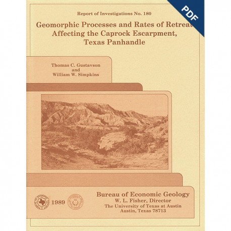
Geomorphic Processes and Rates of Retreat Affecting the Caprock Escarpment, Texas Panhandle. Digital Download
RI0180D
For a print version: RI0180.
RI0180D. Geomorphic Processes and Rates of Retreat Affecting the Caprock Escarpment, Texas Panhandle, by T. C. Gustavson and W. W. Simpkins. 49 p., 30 figs., 6 tables, 1989. doi.org/10.23867/RI0180D. Downloadable PDF.
To purchase this publication in book format, please order RI0180.
ABSTRACT
The interaction of geomorphic and ground-water processes has produced the Caprock Escarpment that bounds the eastern margin of the Southern High Plains in the Texas Panhandle. Spring sapping, slumping, and piping at the surface and salt dissolution in the subsurface are some of the many erosional processes affecting the escarpment.
Substantial thicknesses of bedded Permian salt (halite) have been dissolved from the Salado, Seven Rivers, San Andres, and Glorieta Formations beneath the Caprock Escarpment and the Rolling Plains, east of the escarpment. Dissolution of salt from the Salado and Seven Rivers Formations beneath the Caprock Escarpment has resulted in subsidence and development of a regional dip reversal in the overlying Alibates Formation. Although most dissolution has taken place beneath the Caprock Escarpment and Rolling Plains, dissolution and subsidence extend westward beyond the escarpment to beneath the Southern High Plains. Dissolution-induced subsidence apparently accounts for as much as 75 m (250 ft) of Caprock Escarpment relief.
Complex fracture systems along the escarpment have developed in part because of subsidence. Permian and Triassic strata contain systematic and nonsystematic fractures, extension fractures, and, locally, clastic dikes. The Ogallala Formation contains systematic fractures in basal calcretes and silcretes and, locally, clastic dikes. Of these, the nonsystematic fractures, extension fractures, and clastic dikes probably result from salt dissolution and subsidence. Ground-water leakage downward toward the salt-bearing zones is most likely enhanced by fractures.
Conceptual and numerical models of ground-water flow beneath the Caprock Escarpment suggest that low-salinity ground water flows downward from the Ogallala and Dockum aquifers to dissolve Permian salt. Brines flow eastward through permeable anhydrites, dolomites, and dissolution breccias beneath the Rolling Plains to discharge as springs in topographic lows.
Dissolution is active along the Caprock Escarpment; during a 15-yr period it resulted in the loss of over 15 million m3 (525 million ft3) of salt from the study area. Westward expansion of the active dissolution zone along the Caprock Escarpment and beneath the Rolling Plains occurs at a mean rate of 0.02 km/1,000 yr (0.013 mi/1,000 yr).
Surface erosion on the hillslopes of the Caprock Escarpment occurs by sheetflooding, slope wash, rill wash, rockfalls, spring sapping, piping, and rotational slumping. Fluvial erosion dominates in canyon bottoms. Sheetflooding, slope wash, and rill wash resulting from runoff from episodic, high-intensity rainfall events have modified the upper margin of the escarpment. Runoff from these same events scours canyons and their tributaries. Sapping below areas of spring discharge in strata of the Dockum Group and Ogallala Formation helps to remove sediment and contributes to the development of rockfalls. Numerous rotational slumps and landslides have substantially accelerated slope degradation in Palo Duro Canyon. Large pipes commonly develop along the slip planes of these slumps.
Scarp retreat rates based on surface erosion rates were examined and compared with the subsurface salt dissolution rates. Scarp retreat rates based on projected former positions of the Caprock Escarpment are probably maximum rates that range from 0.06 km/1,000 yr (0.038 mi/1,000 yr) to 0.19 km/1,000 yr (0.119 mi/1,000 yr). Short-term erosion rates based on semiannual measurement of erosion pins and stream headcuts range from 0.01 to 0.03 km/1,000 yr (0.006 to 0.019 mi/1,000 yr). The mean horizontal dissolution rate for salt in the study region is 0.02 km/yr (0.013 mi/yr). Because the Caprock Escarpment parallels and overlies the zone of salt dissolution, the retreat rates of these two features are comparable and appear to converge in the range of 0.01 to 0.20 km/1,000 yr (0.006 to 0.12 mi/1,000 yr).
Discharge from many springs along the Caprock Escarpment has decreased as much as an order of magnitude over the last 50 yr as a result of widespread exploitation of the Ogallala aquifer for irrigation. Because of this trend, associated erosional processes such as spring sapping, slumping, rockfalls, and stream discharge have most likely decreased as well, thus slowing the westward retreat of the Caprock Escarpment.
Keywords: Caprock Escarpment, fractures, geomorphic processes, ground-waterflow systems, Rolling Plains, salt dissolution, scarp retreat rates, Southern High Plains, Texas Panhandle
Contents
Abstract
Introduction
Geologic Setting
Structural Development
Regional Hydrology
Geomorphology and Physiography
Climate
Runoff
Relation of Dissolution-Induced Subsidence to the Caprock Escarpment
Stratigraphy beneath the High Plains, Caprock Escarpment, and Rolling Plains
Structure on the Tubb Interval
Salt Thickness
Structure on the Alibates Formation
Middle Tertiary Erosional Surface
Relation of Post-Ogallala Lake Basins to the Caprock Escarpment
Fracture Systems and Landform Development
Systematic and Nonsystematic Fractures
Clastic Dikes
Ground-Water Flow beneath the Caprock Escarpment
Conceptual Model of Ground-Water Flow beneath the Caprock Escarpment
Numerical Model of Ground-Water Flow beneath the Caprock Escarpment
Modeling Results
Surface Processes Causing Scarp Retreat
Surface Runoff
Drainage Development
Thresholds for Sediment Movement.
Spring Sapping and Seepage Erosion
Rockfalls
Rotational Slumping
Piping
Stages in the Physiographic Development of the Eastern Caprock Escarpment
Rates of Retreat of the Caprock Escarpment
Rates of Interstratal Salt Dissolution along the Caprock Escarpment
Procedure for Calculating Salt Dissolution Rates
Salt Dissolution Rates
Surface Erosion Rates
Effect of Diminished Spring Discharge on Geomorphic Processes
Summary and Conclusions
Acknowledgments
References
Figures
1. Location of the study area in the eastern Texas Panhandle
2. Major structural elements, Texas Panhandle and surrounding area
3. Stratigraphic nomenclature of Permian and younger strata, Texas Panhandle
4. Topography along the Caprock Escarpment
5. Views of the Eastern Caprock Escarpment in Palo Duro Canyon State Park
6. Three-day total rainfall distribution, June 24-26, 1965. along the Eastern Caprock Escarpment
7. Intensity-duration profiles of four storms along the Caprock Escarpment
8. Regional stratigraphic cross section illustrating zones of section lost owing to dissolution of salt and collapse of overlying strata beneath the Southern High Plains, Caprock Escarpment, and Rolling Plains
9. Structure-contour map of the top of the middle Permian Tubb interval
10. Net-thickness map of salt in the Permian upper Clear Fork Group and San Andres, Seven Rivers, and Salado Formations
11. Net-thickness map of salt in the Salado and Seven Rivers Formations
12. Structure-contour map of the top of the Upper Permian Alibates Formation
13. Structure-contour map of the base of the High Plains aquifer (Ogallala Formation)
14. Head map of the unconfined aquifers in the Palo Duro Basin
15. Potentiometric-surface map of lower Dockum Group ground water
16. Map of physiographic units. major streams, and brine emission areas in the study area
17. Conceptual model of ground-water flow and its impact on Permian bedded salt beneath the High Plains Caprock Escarpment and Rolling Plains
18. Finite-element mesh design based on cross section shown in figure 8
19. Steady-state hydraulic heads and recharge/discharge rates computed by ground-water flow model
20. Plot of maximum rainfall intensity versus percent of erosion pins showing erosion at the Buffalo Lake National Wildlife Refuge station
21. Area of spring sapping at the head of Red Canyon, Palo Duro Canyon State Park
22. Detail of the spring discharge area illustrated in figure 21
23. Rockfall consisting of blocks of massive channel sandstones, Upper Triassic Dockum Group at the head of Tub Springs Draw, Palo Duro Canyon State Park
24. a. Fracture in caprock caliche of the Miocene-Pliocene Ogallala Formation at Fortress Cliff, Palo Duro Canyon State Park. b. Fracture in sandstone of the Upper Triassic Dockum Group in Tub Springs Draw
25. Distribution of rotational slumps and landslides in Palo Duro Canyon, Palo Duro Canyon State Park
26. Three segments of rotational slumps exposed along the northeastern side of Palo Duro Canyon
27. Entrance to a large pipe in Caprock Canyons State Park
28. Outlet for a large pipe in Palo Duro Canyon State Park
29. Stages in development of drainage at the Caprock Escarpment
30. Drainage basins and gauging stations in the Rolling Plains
Tables
1. Rainfall intensity-duration-frequency relationships, Amarillo, Texas, 1904-1951
2. Hydrostratigraphic units and hydraulic conductivities used in the ground-water flow model
3. Erosion-pin measurements made on eroded canyon slopes following storm on May 26, 1978
4. Record of intense storms at Buffalo Lake National Wildlife Refuge
5. Dissolved chloride loads for streams, calculated salt volumes, and salt dissolution rates for selected drainage basins, Texas Panhandle
6. Spring discharge rates, Eastern Caprock Escarpment, Texas Panhandle
Citation
Gustavson, T. C., and Simpkins, W. W., 1989, Geomorphic Processes and Rates of Retreat Affecting the Caprock Escarpment, Texas Panhandle:The University of texas at Austin, Bureau of Economic Geology, Report of Investigations No. 180, 49 p.

