|
Surficial evidence of tectonic activity and erosion rates, Palestine, Keechi, and Oakwood salt domes, east Texas |
Collins, E.W. |
1982 |
Geological Circular |
|
Lithology, microstructures, fluid inclusions, and geochemistry of rock salt and of the cap-rock contact in Oakwood Dome, east Texas: significance for nuclear waste storage |
Dix, O.R., Jackson, M.P.A. |
1982 |
Report of Investigations |
|
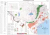
Geothermal resources of Texas, 1982 |
Woodruff, C.M., Jr., Caprio, Laura, Gever, Christine |
1982 |
Energy and Mineral Resource Maps |
|
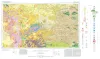
Geologic Atlas of Texas, Fort Stockton sheet (revised 1994) |
Barnes, V.E., Humboldt Oil and Refining Co., Mobil Oil Co., Geophoto Services Inc., Cities Service Petroleum Co., Anderson, J.E., Brown, J.B., Gries, J.C., Lovejoy, E.M.P., McKalips, D.G., Dillon, R.L., Stump, R.W., Pearson, B.T. |
1982 |
Geologic Atlas of Texas |
|
Fault tectonics of the east Texas basin |
Jackson, M.P.A., Wilson, B.D. |
1982 |
Geological Circular |
|
San Andreas carbonates in the Texas panhandle: sedimentation and diagenesis associated with magnesium-calcium-chloride brines |
Bein, Amos, Land, L.S. |
1982 |
Report of Investigations |
|
Depositional architecture of the Cenozoic Gulf coastal plain fluvial systems |
Galloway, W.E. |
1982 |
Geological Circular |
|
Frio Formation of the Texas Gulf Coast basin -- depositional systems, structural framework, and hydrocarbon origin, migration, distribution, and exploration potential |
Galloway, W.E., Hobday, D.K., Magara, Kinji |
1982 |
Report of Investigations |
|
Hydrocarbon accumulation patterns in the east Texas salt dome province |
Wood, D.H., Giles, A.B. |
1982 |
Geological Circular |
|
Petroleum potential of the Palo Duro basin, Texas panhandle |
Dutton, S.P., Goldstein, A.G., Ruppel, S.C. |
1982 |
Report of Investigations |
|
Geology and geohydrology of the Palo Duro basin, Texas panhandle -- a report on the progress of nuclear waste isolation feasibility studies (1981), annual report for period October 1, 1980 - September 30, 1981 |
Gustavson, T.C., Bassett, R.L., Budnik, R.T., Finley, A.C., Goldstein, A.G., McGowen, J.H., Roedder, E., Ruppel, S.C., Baumgardner, R.W., Jr., Bentley, M.E., Dutton, S.P., Fogg, G.E., Hovorka, S.D., McGookey, D.A., Ramondetta, P.J., Simpkins, W.W., Smith, D., Smith, D.A., Duncan, E.A., Griffin, J.A., Merritt, R.M., Naiman, E.R. |
1982 |
Geological Circular |
|
Regional hydrodynamics and hydrochemistry of the uranium-bearing Oakville aquifer (Miocene) of south Texas |
Smith, G.E., Galloway, W.E., Henry, C.D., Gluck, J.K., McIntyre, J.F., Pisasale, E.T., Spradlin, S.D. |
1982 |
Report of Investigations |
|
Deltaic Sedimentation on the Louisiana Coast |
|
1982 |
Gulf Coast Section SEPM |

|
First Cretaceous Specimens of the Beryciform Fish Hoplopteryx from North America |
|
1982 |
Texas Memorial Museum |
|
Atoka Group (Lower to Middle Pennsylvanian), northern Fort Worth basin, Texas: terrigenous depositional systems, diagenesis, and reservoir distribution and quality |
Thompson, D.M. |
1982 |
Report of Investigations |

|
Fossil Mammals from the Lower Buck Hill Group, Eocene of Trans-Pecos Texas: |
|
1982 |
Texas Memorial Museum |
|
Considerations in the extraction of uranium from a fresh-water aquifer -- Miocene Oakville Sandstone, south Texas |
Henry, C.D., Galloway, W.E., Smith, G.E., Childs, C.S., Devine, P.E., Dutton, A.R., Gluck, J.K., McIntyre, J.F., Morton, J.P., Pisasale, E.T., Spradlin, S.D., Townsend, M.A. |
1982 |
Report of Investigations |
|
Occurrence of Exotic Fishes in Texas Waters |
|
1982 |
Texas Memorial Museum |
|
Ground-water hydraulics and hydrochemical facies in Eocene aquifers of the east Texas basin |
Fogg, G.E., Kreitler, C.W. |
1982 |
Report of Investigations |
|
Geology of the Plata Verde Mine, Hudspeth County, Texas |
Price, J.G. |
1982 |
Mineral Resource Circular |