|
Submerged lands of Texas, Corpus Christi area: sediments, geochemistry, benthic macroinvertebrates, and associated wetlands |
White, W.A., Calnan, T.R., Morton, R.A., Kimble, R.S., Littleton, T.G., McGowen, J.H., Nance, H.S., Schmedes, K.E. |
1983 |
Submerged Lands of Texas |
|
Oakwood salt dome, east Texas: geologic framework, growth history, and hydrocarbon production |
Giles, A.B., Wood, D.H. |
1983 |
Geological Circular |
|
Potential for Additional Oil Recovery in Texas |
Fisher, W.L., Galloway, W.E. |
1983 |
Geological Circular |
|
Structure and Mesozoic Stratigraphy of Northeast Mexico |
|
1983 |
Corpus Christi Geological Society |

|
A Checklist and Bibliography of the Iapygoidea...of North America, Central America, and the West Indies |
|
1983 |
Texas Memorial Museum |
|
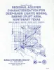
Regional aquifer characterization for deep-basin lignite mining, Sabine uplift area, northeast Texas |
Fogg, G.E., Kaiser, W.R., Ambrose, M.L., Macpherson, G.L. |
1983 |
Geological Circular |

|
Mammals of the Coffee Ranch Local Fauna Hemphillian of Texas |
|
1983 |
Texas Memorial Museum |
|
Geology and geohydrology of the Palo Duro basin, Texas panhandle -- a report on the progress of nuclear waste isolation feasibility studies (1982) |
Gustavson, T.C., Kreitler, C.W., Bassett, R.L., Budnik, R.T., Ruppel, S.C., Baumgardner, R.W., Jr., Caran, S.C., Collins, E.W., Dutton, A.R., Dutton, S.P., Fisher, R.S., Fogg, G.E., Hovorka, S.D., Kolker, A., McGookey, D.A., Orr, E.D., Roberts, M.P., Senger, R.K., Smith, D.A. |
1983 |
Geological Circular |
|
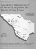
Annotated bibliography of mineral deposits in Trans-Pecos Texas |
Price, J.G., Henry, C.D., Standen, A.R. |
1983 |
Mineral Resource Circular |
|
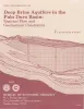
Deep brine aquifers in the Palo Duro basin: regional flow and geochemical constraints |
Bassett, R.L., Bentley, M.E., Duncan, E.A. |
1983 |
Report of Investigations |

|
GCAGS Transactions Volume 33 (1983) Jackson |
|
1983 |
Gulf Coast Association of Geological Societies |
|
Annual Report of the Bureau of Economic Geology 1983 |
University of Texas at Austin, Bureau of Economic Geology |
1983 |
Annual Reports |
|
Origin and diagenesis of cap rock, Gyp Hill and Oakwood salt domes, Texas |
Kreitler, C.W., Dutton, S.P. |
1983 |
Report of Investigations |
|
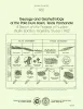
Special Volume: Cretaceous-Wilcox-Frio Symposia |
|
1983 |
Corpus Christi Geological Society |
|
Continuity and Internal Properties of Gulf Coast Sandstones and Their Implications for Geopressured Fluid Production |
Morton, R.A., Ewing, T.E., Tyler, Noel |
1983 |
Report of Investigations |
|
Three-dimensional ground-water modeling in depositional systems, Wilcox Group, Oakwood salt dome area, east Texas |
Fogg, G.E., Seni, S.J., Kreitler, C.W. |
1983 |
Report of Investigations |
|
Depositional setting, structural style, and sandstone distribution in three geopressured geothermal areas, Texas Gulf Coast |
Winker, C.D., Morton, R.A., Ewing, T.E., Garcia, D.D., Chong, L.P., Han, J.H., Lawton, J.L., Padilla y Sanchez, R.J., Palmer, J.J., Rasco, R.D. |
1983 |
Report of Investigations |
|
Oligocene volcanism and multiple caldera formation in the Chinati Mountains, Presidio County, Texas |
Cepeda, J.C., Henry, C.D. |
1983 |
Report of Investigations |
|
Estimation of coal resources in Texas Gulf Coast, Ohio northern Appalachian, and Wyoming Powder River Basins: a comparison of statistical approaches |
Tewalt, S.J., Bauer, M.A., Mathew, David, Roberts, M.P., Ayers Jr., W.B., Barnes, J.W., Kaiser, W.R. |
1983 |
Report of Investigations |

|
Depositional systems in the Nacatoch Formation (Upper Cretaceous), northeast Texas and southwest Arkansas |
McGowan, M.K., Lopez, C.M. |
1983 |
Report of Investigations |