Miscellaneous Maps, Charts & Sections
-
Books & Reports
- Reports of Investigations
- Guidebooks
- Udden Series
- Geological Circulars
- Down To Earth
- Atlases of Major Oil and Gas Reservoirs
- Texas Memorial Museum Publications
- Environmental Geologic Atlas of the Texas Coastal Zone
- Mineral Resource Circulars
- Other Reports
- Seminars and Workshops
- Handbooks
- Submerged Lands of Texas
- Symposia
- Annual Reports
- Open File Reports
-
Maps & Cross Sections
- Thematic Maps
- Miscellaneous Maps, Charts & Sections
- Geologic Atlas of Texas
- STATEMAP Project Maps
- Geologic Quadrangle Maps
- Cross Sections
- Highway Geology Map
- Energy and Mineral Resource Maps
- Shoreline Change and Other Posters
- Wilcox Group, East Texas, Geological / Hydrological Folios
- Bouguer Gravity Atlas of Texas
- River Basin Regional Studies
- Featured Maps
- Posters
- Teachers & the Public
-
Geological Society Publications
- Gulf Coast Association of Geological Societies
- Alabama Geological Society
- Austin Geological Society
- Corpus Christi Geological Society
- Houston Geological Society
- Lafayette Geological Society
- Mississippi Geological Society
- New Orleans Geological Society
- South Texas Geological Society
- GCS SEPM Publications
- Historic BEG & UT Series


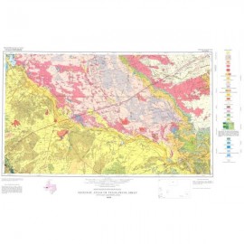
Southern Franklin Mountains, El Paso, Texas, with Focus on Collapse Breccias
MM0049
For a downloadable, digital version: MM0049D.
MM0049. Geologic Map of the Southern Franklin Mountains, El Paso, Texas, with Focus on Collapse Breccias, by F. J. Lucia. 2011. Oversized color map, scale 1:100,000. Includes color photos.
To purchase this map as a downloadable PDF, please order MM0049D.
About This Publication
As this map shows, major collapse breccias are located north of Ranger Peak and at the head of McKelligon Canyon. They range from tens of feet to more than 1,000 feet. More details, and a list of references, are provided on the map.
Keywords: breccias, collapse breccias, maps, geologic maps, El Paso area, Franklin Mountains, McKelligon Canyon, Ranger Peak, Texas, West Texas
Citation
Lucia, F. J., 2011, Geologic Map of the Southern Franklin Mountains, El Paso, Texas, with Focus on Collapse Breccias: The University of Texas at Austin, Bureau of Economic Geology, Miscellaneous Map No. 49, map scale 1:100,000.