Publications in Smith
| Title | Publication Year Sort ascending | Abstract | Author | Series | Publisher | |
|---|---|---|---|---|---|---|
|
Hydrocarbon accumulation patterns in the east Texas salt dome province | 1982 | Mobilization of the Louann Salt created the present structural configuration in the central part of the East Texas Basin and was the major control on hydrocarbon accumulation in the area. Salt-cored anticlines, turtle-structure anticlines, and salt diapirs were produced by flow of salt. |
Wood, D.H., Giles, A.B. | Geological Circular | Bureau of Economic Geology |
|
Regional structural cross sections and general stratigraphy, east Texas basin | 1981 | Jurassic, Cretaceous, and Tertiary sediments in the East Texas Basin have been structurally modified by movement of Middle Jurassic Louann Salt. |
Wood, D.H., Guevara, E.H. | Cross Sections | Bureau of Economic Geology |
|
Geology and geohydrology of the east Texas basin -- a report on the progress of nuclear waste isolation feasibility studies (1980) | 1981 | The third year of research was highlighted by the integration of regional basinal studies with growth histories for specific domes, studies of cap-rock diagenesis and salt deformation, preliminary studies of ground-water flow and geochemistry around Oakwood Dome, and preliminary studies of micros |
Kreitler, C.W., Collins, E.W., Davidson, E.D., Dix, O.R., Donaldson, G.A., Dutton, S.P., Fogg, G.E., Giles, A.B. | Geological Circular | Bureau of Economic Geology |
|
Geology and geohydrology of the east Texas basin -- a report on the progress of nuclear waste isolation feasibility studies (1979) | 1980 | Analysis during the second year was highlighted by a historical characterization of East Texas Basin infilling, the development of a model to explain the growth history of the domes, the continued studies of the Quaternary in East Texas, and a better understanding of the near-dome and regional hy |
Kreitler, C.W., Agagu, O.K., Basciano, J.M., Collins, E.W., Dix, O.R., Dutton, S.P., Fogg, G.E., Giles, A.B. | Geological Circular | Bureau of Economic Geology |

|
Environmental geology of the Wilcox Group lignite belt, east Texas | 1979 | This report provides a data base for decisions about lignite mining and reclamation in the Wilcox Group of East Texas. Kaiser (1974, 1978) estimates that about 12.2 billion short tons of potentially strip-minable lignite resources occur in East and South Texas. |
Henry, C.E., Basciano, J.M. | Report of Investigations | Bureau of Economic Geology |
|
Rock and mineral resources of east Texas | 1965 | In the past 100 years, more than 100 names have been used to designate parts or all of the outcropping Midway and Wilcox rocks in the Gulf Coastal Plain; less than half of these names are used currently by Coastal Plain geologists, and the validity of some of the remaining named rock units has be |
Fisher, W.L., Chelf, C.R., Shelby, C.A., Garner, L.E., Owen, D.E., Shofield, D.A. | Report of Investigations | Bureau of Economic Geology |
|
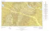
Geologic Atlas of Texas, Tyler sheet | 1964 | Geologic map that depicts the surface geology of Rains, Wood, Upshur, Marion, Harrison, Smith, and Gregg Counties and parts of Camp, Cass, Panola, Rusk, Cherokee, Anderson, Henderson, Van Zandt, Hunt, Morris, Franklin, and Hopkins Counties, Texas. |
Barnes, V.E., Shell Oil Co., Humble Oil and Refining Co., Mobil Oil Co., Pan American Petroleum Corp., Eaton, R.W., Wright, A.C., McCallum, H.D. | Geologic Atlas of Texas | Bureau of Economic Geology |
|
The Geology of Henrys Chapel Quadrangle, Northeastern Cherokee County, Texas | 1953 | Stenzel, H.B. | UT Publication | ||
|
The Van oil field, Van Zandt County, Texas | 1936 | Liddle, R.A. | UT Bulletin | ||
|
Some Well Records in Smith County Texas | 1929 | These circulars issued from the Bureau of Economic Geology contain the record of cores and cuttings from well received and described in the Bureau. |
Well Record |