Publications in Brewster
| Title | Publication Year Sort ascending | Abstract | Author | Series | Publisher | |
|---|---|---|---|---|---|---|
|
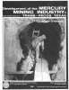
Development of the mercury mining industry in Texas | 1980 | Sharpe, R.D. | Mineral Resource Circular | Bureau of Economic Geology | |
|
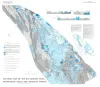
Geologic setting and geochemistry of thermal water and geothermal assessment, Trans-Pecos Texas | 1979 | Hot springs and wells in West Texas and adjacent Mexico are manifestations of active convective geothermal systems concentrated in a zone along the Rio Grande between the Quitman Mountains and Big Bend National Park. |
Henry, C.D. | Report of Investigations | Bureau of Economic Geology |
| |
Geologic Atlas of Texas, Emory Peak-Presidio sheet | 1979 | Geologic map that depicts the surface geology of parts of Presidio, Brewster, and Terrell Counties, Texas. The 14-page booklet indicates geologic formations, abbreviations, and ages. |
Barnes, V.E., Geophoto Services Inc., Cities Service Petroleum Co., Mobil Oil Co., Cepeda, N.J., Daugherty, F.W., Brown, J.B., Norman, D.B. | Geologic Atlas of Texas | Bureau of Economic Geology |
|
Tectonic map of the Rio Grande area, Trans-Pecos Texas and adjacent Mexico | 1977 | Henry, C.D., Bockoven, N.T. | Miscellaneous Map | Bureau of Economic Geology | |
|
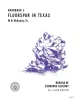
Fluorspar in Texas | 1974 | Fluorspar is a basic raw material used in the chemical, metallurgical, and ceramic industries. This handbook describes the occurrence, grades, geology, uses, and prospects for development of fluorspar in Texas. |
McAnulty, W.N. | Handbook | Bureau of Economic Geology |
|
Correlation of Tertiary rock units, West Texas | 1970 | Tertiary rocks, including sandstone, conglomerate, shale, pyroclastics, tuff, and lava, are preserved in Big Bend National Park and in a much larger area to the west and northwest. Some of the rocks have distinctive characteristics that enable recognition by their lithology. |
Maxwell, R.A., Dietrich, J.W. | Report of Investigations | Bureau of Economic Geology |

|
Geologic map of the Bofecillos Mountains area, Trans-Pecos Texas | 1970 | The Bofecillos Mountains area of Trans-Pecos Texas contains a Tertiary volcanic vent and a varied sequence of lava flows, tuff, ash-flow tuff, and associated conglomerate, sandstone, and mudrock; after most of the volcanic activity had ceased, the area was block faulled and later dissected into a |
McKnight, J.F. | Geologic Quadrangle Map | Bureau of Economic Geology |
|
The Big Bend of the Rio Grande -- a guide to the rocks, landscape, geologic history, and settlers of the area of Big Bend National Park | 1968 | The scene is set. According to Indian legend, when the Great Creator made the earth and had finished placing the stars in the sky, the birds in the air, and the fish in the sea, there was a large pile of rejected stony materials left over. |
Maxwell, R.A. | Guidebook | Bureau of Economic Geology |
|
Geology of Big Bend National Park, Brewster County, Texas | 1967 | Maxwell, R.A., Lonsdale, J.T., Hazzard, R.T., Wilson, J.A. | UT Publication | ||
|
Fluorspar in Brewster County, Texas | 1967 | Since production of fluorspar began in northern Coahuila, Mexico, in 1950-51, thousands of tons of high-grade ore have been mined from numerous deposits situated 5 to 75 miles south of the Rio Grande. |
McAnulty, W.N. | Geological Circular | Bureau of Economic Geology |