From 1952 to 1956, Pemex conducted a considerable amount of stratigraphic field work in the eastern Sierra Madre and in Laramide folds to the north across the Sabinas Basin. Special thanks and consideration are extended to Pemex for releasing this classic work, in which 76 stratigraphic sections were measured and described, resulting in this significant internal company report by William E. Humphrey and Teodoro Diaz. The former was initially employed by the consulting firm of DeGolyer and MacNaughton; the latter was employed by Pemex.
"When in the early 1980’s it became known that the Federal Government was planning to undertake the construction of the massive Superconducting Super Collider (SSC) project, scientists in the various states, still without precise information on the criteria to be established for site selection, began to seek ways in which they, and their states, could participate in the project.
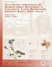
Oil and gas resources on University Lands, 2.1 million acres in 19 West Texas counties, constitute a major asset of the University of Texas System. The original oil in place (OOIP) of the 102 major University Lands oil reservoirs is calculated to be 7,520 MMbbl. Components of the calculated OOIP include residual oil (3,761 MMbbl, 49 percent), cumulative production (1,702 MMbbl through 1999, 23 percent), remaining reserves (125 MMbbl, 2 percent), and unrecovered mobile oil (1,932 MMbbl, 26 percent).
This nontechnical guidebook describes seven trails that visitors can walk within Pedernales (Spanish for the "flint" found in the park area) State Park, near Johnson City, in the Hill Country of Texas. Included are numerous color photos, brief discussions of the park's geology, human history, and Pedernales River, and a geologic map of the park.