
Publication Year
2022
Publisher
Series
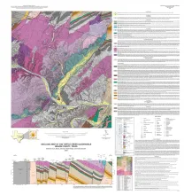
Open-File Map
Publication Year
2022
Publisher
Series
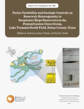
Report of Investigations
Abstract
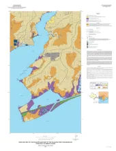
Deepwater slope deposits in the Virgilian- Wolfcampian Cisco Group in Lake Trammel South field in Nolan County, Texas, have produced oil and gas since the early 1950’s. Nevertheless, the field and adjacent areas have the potential for additional development. Many lenticular and discontinuous reservoir-sandstone bodies in the field have not been adequately contacted by existing wells.
Publication Year
2022
Publisher
Series
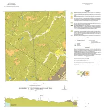
Open-File Map
Publication Year
2022
Publisher
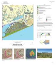
Series
Open-File Map
Publication Year
2021
Publisher
Series
Open-File Map