Pennsylvanian Publications
| Title | Publication Year Sort ascending | Abstract | Author | Series | Publisher | |
|---|---|---|---|---|---|---|
|
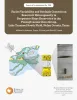
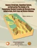
Facies variability and geologic controls on reservoir heterogeneity in deepwater slope reservoirs in the Pennsylvanian Cisco Group, Lake Trammel South field, Nolan County, Texas | 2022 | Deepwater slope deposits in the Virgilian- Wolfcampian Cisco Group in Lake Trammel South field in Nolan County, Texas, have produced oil and gas since the early 1950’s. Nevertheless, the field and adjacent areas have the potential for additional development. |
Ambrose, W.A., Hentz, T.F., Smith, D.C. | Report of Investigations | Bureau of Economic Geology |
|
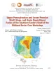
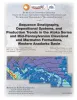
Upper Pennsylvanian and Lower Permian Shelf-to-Basin Facies Architecture and Trends, Eastern Shelf of the Southern Midland Basin, West Texas | 2017 | Our study documents the shelf, shelf-edge, slope, and basin-floor depositional facies characteristics, stratigraphic variations, and sedimentation trends of the Missourian Canyon Group and Virgilian–Wolfcampian Cisco Group across the southern Eastern Shelf and the adjacent Midland Basin. |
Hentz, T.F., Ambrose, W.A., Hamlin, H.S. | Report of Investigations | Bureau of Economic Geology |
|
Upper Pennsylvanian and Lower Permian Shelf, Slope, and Basin Depositional Facies of the Southern Eastern Shelf of the Midland Basin: Core Workshop | 2017 | Hentz, T.F., Ambrose, W.A., Palacios, F.C., Baumgardner, R.W., Jr. | Seminars and Workshops | Bureau of Economic Geology | |
|
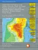
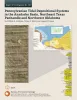
Pennsylvanian Tidal Depositional Systems in the Anadarko Basin, Northeast Texas Panhandle and Northwest Oklahoma | 2015 | A thick (>6,000-ft [>1,830-m]) succession of Desmoinesian to Virgilian (Pennsylvanian) strata in the northwest part of the Anadarko Basin contains a variety of tide-modified deposits. |
Ambrose, W.A., Tussey, L.B. | Report of Investigations | Bureau of Economic Geology |
|
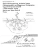
Sequence Stratigraphy, Depositional Systems, and Hydrocarbon Play Analysis of the Pennsylvanian Cleveland Formation and Marmaton Group, Anadarko Basin, North Texas and Western Oklahoma | 2011 | This report provides a detailed review of the stratigraphic and structural attributes and controls on productivity and future potential of the Cleveland Formation and Marmaton Group by integrating chronostratigraphic, depositional-facies, and play analysis. |
Ambrose, W.A. | Report of Investigations | Bureau of Economic Geology |
|
Sequence Stratigraphy, Depositional Systems, and Production Trends in the Atoka Series and Mid-Pennsylvanian Cleveland and Marmaton Formations, Western Anadarko Basin | 2009 | Carr, David, Hentz, T.F., Ambrose, W.A., Potter, E.C., Clift, S.J. | Seminars and Workshops | Bureau of Economic Geology | |
|
Depositional, structural, and sequence framework of the gas-bearing Cleveland Formation (Upper Pennsylvanian), western Anadarko basin, Texas panhandle | 1994 | ow-permeability ("tight") reservoir sandstones of the lower Missourian Cleveland formation produced more than 435 billion cubic feet (Bcf) of natural gas through December 1990, mostly from Ochiltree and Lipscomb Counties in the northeastern Texas Panhandle. |
Hentz, T.F. | Report of Investigations | Bureau of Economic Geology |
|
Regional depositional systems tracts, paleogeography, and sequence stratigraphy, Upper Pennsylvanian and Lower Permian strata, north- and west-central Texas | 1990 | Sixteen depositional sequences, commonly called cyclothems, each composed mostly of limestone(retrogradational/transgressive) and siliciclastic (progradational/regressive) subsequences, or systems tracts, record the paleogeography during Late Pennsylvanian (Virgilian Epoch) and Early Permian (Wol |
Brown, L.F., Jr., Solis-Iriarte, R.F., Johns, D.A. | Report of Investigations | Bureau of Economic Geology |
|
Regional stratigraphic cross sections, Upper Pennsylvanian and Lower Permian strata (Virgilian and Wolfcampian Series), north-central Texas | 1987 | This cross section set comprises 14 dip (E-W) sections and 9 strike (N-S) stratigraphic cross sections (with text), correlating upper Pennsylvanian (Virgilian) and lower Permian (Wolfcampian) strata throughout the subsurface in all or parts of 28 counties of North-Central Texas. |
Brown, L.F., Jr., Solis-Iriarte, R.F., Johns, D.A. | Cross Sections | |
|
Organic geochemistry of the Pennsylvanian and Lower Permian, Palo Duro basin, Texas | 1986 | Cores from deep stratigraphic test wells provide an excellent basis for determination of source-rock quality and thermal maturity of potential hydrocarbon source rocks in the Palo Duro Basin. Total organic carbon (TOC) content in Pennsylvanian and Wolfcampian rocks is highest in basinal shales. |
Dutton, S.P. | Geological Circular | Bureau of Economic Geology |