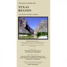
This colorful geologic map published by AAPG—developed with assistance from the Bureau of Economic Geology—highlights state and regional surface rock outcrops, detailing their age, depositional environments, rock types, and formation names. The map is printed on a single sheet and folded to glove compartment size. It also features major highways, towns, landmarks, a stratigraphic column by state, mileage charts, and other interesting information about Texas geology.

A thick (>6,000-ft [>1,830-m]) succession of Desmoinesian to Virgilian (Pennsylvanian) strata in the northwest part of the Anadarko Basin contains a variety of tide-modified deposits. This succession, which encompasses the Marmaton Group (Upper Desmoinesian), Cleveland Formation (Missourian) and Douglas Group (Virgilian), records progradation of highstand tide-modified delta and littoral systems punctuated by lowstand incised-valley deposits.