The Oakville Sandstone (Miocene) of the Texas Coastal Plain comprises a major sand-rich fluvial system composed of deposits of several major and minor rivers that originated within Texas and surrounding states. Broad bed-load fluvial axes, including the Hebbronville, George West, and New Davy trends, lie south of the San Marcos Arch and host significant reserves of uranium. To the north, the Moulton streamplain consists of deposits of numerous small, flashy to ephemeral streams that drained the inland margin of the Coastal Plain.
Environmental geologic maps of the Texas lignite belt were prepared in response to renewed production of lignite in Texas and enactment of Federal and State laws governing coal and lignite surface mining. The map area of this report encompasses the outcrop of the Yegua Formation and Jackson Group from south-central Texas to the Texas-Louisiana border. Yegua sediments are fluvial in outcrop, and deltaic in the deeper subsurface. Jackson deposits are predominantly of deltaic origin. Mapping involved interpretation of black-and-white, large-scale aerial photographs and extensive field work.
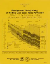
Integrated study of the basin structure, tectonic history, rock physics, physical stratigraphy, hydrogeology, geochemistry, natural resources, and geomorphology of the Palo Duro and Dalhart Basins in the Texas Panhandle is part of a national evaluation of ancient salt basins as potential sites for isolation and management of nuclear wastes.
The Oakville Formation consists of sediments deposited by several major fluvial systems that traversed the Texas Coastal Plain during the Miocene Epoch. Facies geometry and composition, together with superimposed structure and topography, are important determinants of ground-water flow, aquifer transmissivity, and regional hydrochemical evolution.