Publication Year
1992
Series
Gulf Coast Association of Geological Societies
Publication Year
1992
Publisher
Series
Texas Memorial Museum
Publication Year
1992
Series
Annual Reports
Abstract
Annual report for the Bureau of Economic Geology 1992
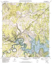
Publication Year
1992
Publisher
Series
Open-File Map
Publication Year
1992
Publisher
Series
Report of Investigations
Abstract
Chemical and physical approaches are used to study unsaturated flow; however, few studies include an in-depth analysis of data from both approaches. Detailed chemical tracer studies were conducted at a site in the Chihuahuan Desert of Texas, and the results were compared with hydraulic attributes of the system. Estimated soil-moisture fluxes from both chemical and physical approaches were compared to better understand the hydrologic processes in the unsaturated zone.Chemical tracer studies included mass balance of the chloride ion.