Geologic Maps Publications
|
Title |
Publication Year
Sort ascending
|
Abstract |
Author |
Series |
Publisher |
|
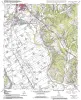
Geologic map of the Hammond quadrangle, Texas |
2006 |
|
Collins, E.W. |
Open-File Map |
Bureau of Economic Geology |
|
Geologic map of the Maysfield quadrangle, Texas |
2006 |
|
Collins, E.W. |
Open-File Map |
Bureau of Economic Geology |
|
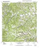
Geologic map of the Calvert quadrangle, Texas |
2006 |
|
Collins, E.W. |
Open-File Map |
Bureau of Economic Geology |
|
Geologic map of the Gause quadrangle, Texas |
2006 |
|
Collins, E.W. |
Open-File Map |
Bureau of Economic Geology |
|
Geologic map of the Hearne South quadrangle, Texas |
2006 |
|
Collins, E.W. |
Open-File Map |
Bureau of Economic Geology |
|
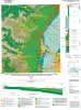
Geologic map of the west half of the Taylor, Texas, 30 X 60 minute quadrangle: central Texas urban corridor, encompassing Round Rock, Georgetown, Salado, Briggs, Liberty Hill, and Leander |
2005 |
|
Collins, E.W. |
Miscellaneous Map |
Bureau of Economic Geology |
|
Geologic map of the Fall Creek quadrangle, Texas |
2004 |
|
Collins, E.W. |
Open-File Map |
Bureau of Economic Geology |
|
Geologic map of the Hunt quadrangle, Texas |
2004 |
|
Collins, E.W. |
Open-File Map |
Bureau of Economic Geology |
|
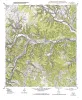
Geologic map of the Kerrville quadrangle, Texas |
2004 |
|
Collins, E.W. |
Open-File Map |
Bureau of Economic Geology |
|
Geologic map of the Legion quadrangle, Texas |
2004 |
|
Collins, E.W. |
Open-File Map |
Bureau of Economic Geology |