Bureau of Economic Geology Publications
| Title | Publication Year Sort ascending | Abstract | Author | Publisher | |
|---|---|---|---|---|---|
|
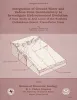
Deposition and diagenesis in a marine-to-evaporite sequence: Permian Upper Wolfcamp Formation and Lower Wichita Group, Palo Duro basin, Texas panhandle | 1990 | Lower Permian Wolfcamp and Wichita carbonates and anhydrites in the Palo Duro Basin, Texas Panhandle, record a change from normal-marine to marine evaporite depositional environment. |
Fisher, R.S., Posey, H.H. | Bureau of Economic Geology |
|
Facies heterogeneity and brine-disposal potential of Miocene barrier island, fluvial, and deltaic systems: examples from northeast Hitchcock and Alta Loma fields, Galveston County, Texas | 1990 | To recover gas remaining in solution, large volumes of brine must be produced from watered-out gas reservoirs in the Gulf Coast. |
Ambrose, W.A. | Bureau of Economic Geology |
|
Neotectonic history and structural style of the Campo Grande fault, Hueco basin, Trans-Pecos Texas | 1990 | The Hueco Basin of Trans-Pecos Texas and Chihuahua, Mexico, formed in response to Basin and Range extensional tectonism that began about 24 Ma ago and continues to the present. |
Collins, E.W., Raney, J.A. | Bureau of Economic Geology |
|
Geologic and Engineering Approaches in Evaluation of San Andres/Grayburg Hydrocarbon Reservoirs--Permian Basin | 1990 | Bebout, D.G., Harris, P.M. | Bureau of Economic Geology | |
|
Integration of ground-water and vadose-zone geochemistry to investigate hydrochemical evolution: a case study in arid lands of the northern Chihuahuan Desert, Trans-Pecos Texas | 1990 | The hydrochemical history of ground water in the arid southeastern Hueco Bolson and southwestern Diablo Plateau was investigated by collecting soil-moisture samples from unsaturated siliciclastic bolson-fill sediments and groundwater samples from the Diablo Plateau aquifer, the Hueco Bolson silt |
Fisher, R.S., Mullican, W.F. | Bureau of Economic Geology |
|
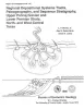
Regional depositional systems tracts, paleogeography, and sequence stratigraphy, Upper Pennsylvanian and Lower Permian strata, north- and west-central Texas | 1990 | Sixteen depositional sequences, commonly called cyclothems, each composed mostly of limestone(retrogradational/transgressive) and siliciclastic (progradational/regressive) subsequences, or systems tracts, record the paleogeography during Late Pennsylvanian (Virgilian Epoch) and Early Permian (Wol |
Brown, L.F., Jr., Solis-Iriarte, R.F., Johns, D.A. | Bureau of Economic Geology |
|
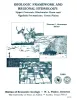
Geologic Framework and Regional Hydrology: Upper Cenozoic Blackwater Draw and Ogallala Formations, Great Plains | 1990 | Gustavson, T.C. | Bureau of Economic Geology | |
|
Tertiary and Quaternary stratigraphy and vertebrate paleontology of parts of northwestern Texas and eastern New Mexico | 1990 | This field guide summarizes recent interpretations of the upper Cenozoic stratigraphy of parts of the Southern High Plains and Rolling Plains in northwestern Texas and eastern New Mexico. |
Gustavson, T.C., Holliday, V.T., Osterkamp, W.R., Schultz, G.E., Winkler, D.A. | Bureau of Economic Geology |
|
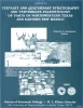
Hydrogeology of Trans-Pecos Texas | 1990 | This guidebook, Hydrogeology of Trans-Pecos Texas, grew out of our interest in the hydrogeology of desert environments. |
Kreitler, C.W., Sharp, J.M. | Bureau of Economic Geology |
|
Reservoir Modeling of Restricted Platform Carbonates: Geologic/Geostatistical Characterization of Interwell-Scale Reservoir Heterogeneity, Dune Field, Crane County, Texas | 1990 | Petroleum reservoirs typically yield only a fraction of the oil initially in place because geologic heterogeneity causes incomplete drainage of oil. |
Fogg, G.E., Lucia, F.J. | Bureau of Economic Geology |