|
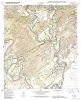
Geologic map of the Rough Hollow quadrangle, Texas |
Collins, E.W. |
2002 |
Open-File Map |
|
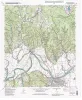
Geologic map of the Shingle Hills quadrangle, Texas |
Collins, E.W. |
2002 |
Open-File Map |
|
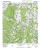
Geologic map of the Whitworth Ranch quadrangle, Texas |
Collins, E.W. |
2002 |
Open-File Map |
|
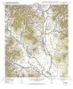
Geologic map of the Beaukiss quadrangle, Texas |
Collins, E.W. |
2001 |
Open-File Map |
|
Geologic map of the Circle Bluff quadrangle, Texas |
Collins, E.W. |
2001 |
Open-File Map |
|
Geologic map of the Fedor quadrangle, Texas |
Collins, E.W. |
2001 |
Open-File Map |
|
Geologic map of the Knippa quadrangle, Texas |
Collins, E.W. |
2001 |
Open-File Map |
|
Geologic map of the Lexington quadrangle, Texas |
Collins, E.W. |
2001 |
Open-File Map |
|
Geologic map of the Rio Frio quadrangle, Texas |
Collins, E.W. |
2001 |
Open-File Map |
|
Geologic map of the McDade quadrangle, Texas |
Collins, E.W. |
2001 |
Open-File Map |
|
Geologic map of the Winchester quadrangle, Texas |
Collins, E.W. |
2001 |
Open-File Map |
|
Geologic map of the Paige quadrangle, Texas |
Collins, E.W. |
2001 |
Open-File Map |
|
Geologic map of the Concan quadrangle, Texas |
Collins, E.W. |
2001 |
Open-File Map |
|
Geologic map of the Smithville Quadrangle, Texas |
Collins, E.W. |
2001 |
Open-File Map |
|
Geologic map of the Smithville NW Quadrangle, Texas |
Collins, E.W. |
2001 |
Open-File Map |
|
Geologic map of the Vanderpool quadrangle, Texas |
Collins, E.W. |
2000 |
Open-File Map |
|
Geologic map of the Lake Bastrop Quadrangle, Texas |
Collins, E.W. |
2000 |
Open-File Map |
|
Geologic map of the Structure Quadrangle, Texas |
Collins, E.W. |
2000 |
Open-File Map |
|
Geologic map of the Utley Quadrangle, Texas |
Collins, E.W. |
2000 |
Open-File Map |
|
Geologic map of the Blanco Lake quadrangle, Texas |
Collins, E.W. |
2000 |
Open-File Map |